Setting
|
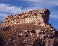
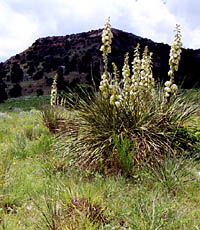
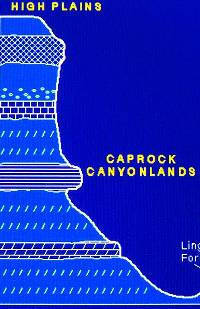
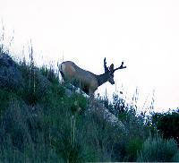
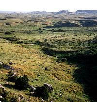
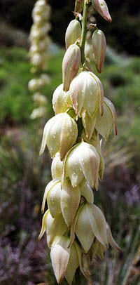
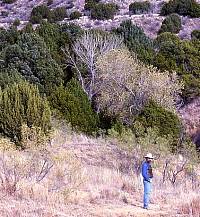
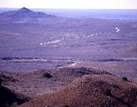
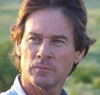
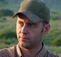
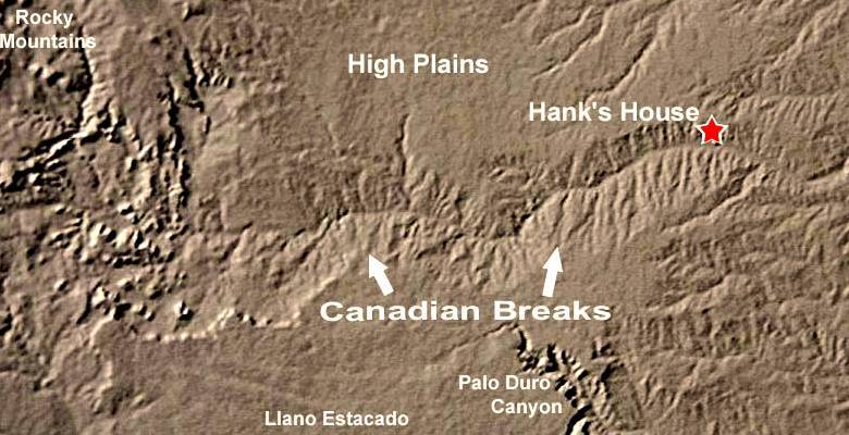
The M-Cross Ranch is located about 25 miles southeast of Perryton, Texas, and just north of the Canadian River valley. The northern portion of the ranch is on the flat, treeless expanse of grassland known as the High Plains, but most of the ranch extends down into the Canadian Breaks, a rugged landscape formed by erosion. Over many hundreds of thousands of years, as the Canadian River gradually cut its way through the layers of earth and rock, it washed away untold billions of tons of sediment. The process exposed the Ogallala formation and created numerous steep-walled canyons. The Ogallala formation consists of various layers of gravels and sands but is capped by a thick layer of hard caliche that forms the caprock edge of the High Plains. Because this caliche layer is more resistant to erosion than the underlying layers, it also forms the rim of the canyons in the Canadian Breaks. The geology of the area helps explain the natural resources there. The Ogallala formation is buried under most of the High Plains, from Texas up into Canada, and it is one of the most important freshwater aquifers in the United States. An aquifer is simply an underground pool of water trapped in the sediment. As rainwater soaks down through the soil and through cracks in the rocks, it begins to collect within certain layers deep underground. These aquifer layers may contain billions of gallons of water. In the twentieth century, technology allowed humans to pump water from the Ogallala aquifer all across the High Plains, first with windmills and later with modern gas or electric-powered pumps. Prehistoric people couldn't dig deep wells to pump the water, but they didn't have to because the water flows out naturally in many places, called springs. Freshwater springs occur in deep canyons where erosion has exposed much of the Ogalalla formation and the waters trapped in the aquifer simply flow out of the porous lower layers. The Texas Panhandle climate is called "semi-arid," meaning that it is pretty darn dry. The average precipitation on the High Plains is about 18 inches a year, but the distribution of rainfall is quite variable and unpredictable in any given year and between years. Drought conditions—periods when the amount of rainfall is much less than average —are common and may last for a few months or several years. Water is a very important resource for people who live there today, and this was true throughout prehistory. Because of the many springs emerging in the canyons of the Canadian River Breaks, this region was literally an oasis in an otherwise near-desert environment. The springs and spring-fed creeks provided abundant water in the canyons, and the water supported a wide range of plant life. The abundant water and plant life, in turn, attracted a diverse range of animals. Locations where abundant water, plants, and animals were present have always attracted people, and the Canadian River Breaks were no exception. Archeologists have found good evidence that people have been visiting the breaks for at least 13,500 years. The list of plants and animals available to prehistoric peoples in the Canadian River Breaks is too long to present here, but several important sources of food warrant mention. Certainly people hunted, killed, and ate many types of birds, reptiles, fish, mussels, amphibians, and small mammals (such as rabbits, rodents, and prairie dogs), but the three largest mammals—buffalo, deer, and antelope—were the most important sources of meat and also of hides. The buffalo was especially important because one animal could provide many hundreds of pounds of meat. The list of wild plant foods that were probably used is even more extensive. Some of the more important plant foods were mesquite beans, fruits and pads of prickly pear and other cacti, leaves and seeds of various grasses and forbs (such as sunflower, chenopodium, and amaranth), grapes and plums, yucca roots and flower petals, shin oak acorns, and hackberry seeds. Relatively speaking, the Canadian River Breaks was rich in resources. The late Jack T. Hughes (former professor of anthropology at West Texas State University) used to say that the canyonlands of the Texas Panhandle were a grocery store of resources if you knew how to shop there. Hank's site is located about five miles north of the Canadian River, tucked away in a beautiful canyon near the head of a spring-fed tributary. John Erickson calls this canyon the "West Pasture," and the main spring along this canyon is called Indian Springs. This spring still flows today, but it is only a trickle compared to what it would have been in prehistoric times long before modern gas-powered engines were used to pump water out of the Ogallala aquifer in the twentieth century. Prehistoric people were drawn to the West Pasture valley because of the abundant fresh water and the plants and animals available there. Several archeologists have been working with John Erickson to learn more about the archeological sites on the M-Cross ranch. Doug Wilkens, a resident of Perryton, Texas and a Panhandle regional steward with the Texas Historical Commission's Texas Archeological Stewardship Network (TASN), began doing archeological studies on the ranch in the early 1990s. The TASN is a network of dedicated volunteer archeologists who work with people in their own area to promote protection, preservation, and documentation of archeological sites and information. Wilkens is extremely knowledgeable in the archeology of his region and an important advocate for why scientific archeology is far more meaningful than simply collecting artifacts. Over a period of several years, Wilkens and Erickson surveyed many parts of the ranch, recorded dozens of sites including many large and important village sites in the West Pasture, and conducted test excavations at some of the sites. Wilkens and Erickson also enticed two other individuals to become involved with the archeological research on the M-Cross. One is Brett Cruse, an archeologist with the Texas Historical Commission who directs the TASN program for the Texas Panhandle region. The other is me, Doug Boyd, a vice president with a cultural resources contracting firm in Austin, Texas. The one thing that the four of us have in common is we all were born and raised in the Texas Panhandle and have a deep appreciation for all the people who lived there before us. |
|