Rock Walls and Corral Complex
|
It is clear from the data analysis that some rock alignments represent property boundaries (e.g., Rock Wall A), while others represent parallel alignments of stones piled along two edges of an old roadway (Rock Alignments B1/B2 and C1/C2). In some cases, large concentrations of flint cobbles and smaller limestone nodules were found, indicating that the stones were probably dumped along certain rock alignments as they were encountered during the cultivation of fields. Similarly, the three features designated as Rock Mounds A, B, and C appear to have originated in the same manner. Backhoe trenching revealed that these are low mounds of rocks, primarily flint cobbles and limestone nodules, that are isolated with vegetation clusters. Each time one of the Williamses was plowing and hit a rock, it would end up in one of these rock piles. Without doubt, the most substantial and intact rock walls were in the northern area where the linear walls all converge in the vicinity of the pond location. This area was designated as the corral complex. It also appears that some rocks were removed from these walls in modern times, and such scavenging is most obvious in areas where vehicle access was easy. |
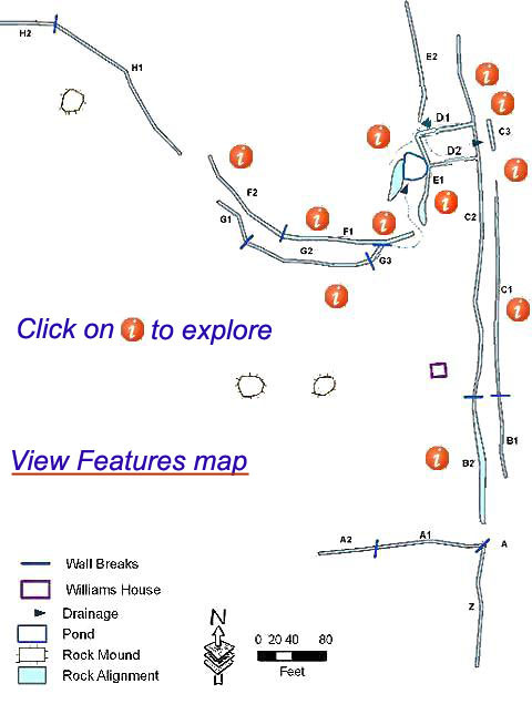 This map shows all of the large features at the Williams farmstead that were mapped within the proposed SH 45 Southwest right of way for the landscape analysis. In addition to the house location, other documented features associated with the Williams occupation are the large linear rock walls and alignments, a livestock pond, and three rock mounds. Letters and numbers designate the rock wall and alignment sections.