Setting
Schematic cross-section showing the evolution of Galveston Island. Based on Rodriquez et al. 2004 and Fisk et al. 1972. |
|
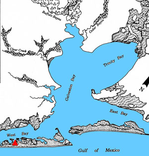
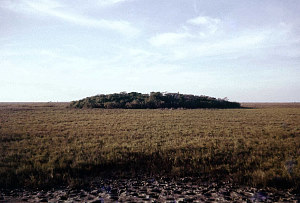
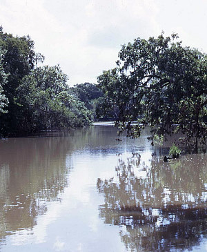
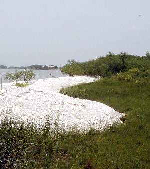
The human story of the Mitchell Ridge site is intertwined with that of the natural history of Galveston Island and of the Galveston Bay area. Formation of Galveston IslandGalveston Island is a classic example of a barrier island, a long narrow strip of sand and shell that runs parallel to the shore, separated by a bay or lagoon. Such islands are formed by deposits of sand and shell piled up by ocean waves and long-shore currents. Measured in geological time, Galveston Island is a very young landform that had not yet begun to form as recently as 6,000 years ago, during the mid-Holocene geological period. As compared to today, 8,000 years ago sea level was considerably lower by perhaps 5-10 meters (16-33'). At this time the Texas coastline and earlier barrier islands were considerably farther out into the Gulf by an estimated 55 kilometers (34 miles) at the west end of Galveston Island. An ancestral Galveston Bay existed as a much narrower and deeper feature that formed as sea level climbed in the early Holocene and flooded the deeply incised valleys of the Trinity and San Jacinto Rivers. The ancient bay was protected by barrier islands and, in the upper (innermost) bay, a productive estuary formed with comparatively brackish water (low salinity) in which certain species of shellfish such as Rangia cuneata clams flourished. As sea level rose during the mid-Holocene, the ancestral bay became larger and more rounded in outline as the adjacent low-lying coastal plains were inundated and wave action "hollowed out" the bay. Around 5000 years ago, Galveston Island began forming as wave action, particularly that generated by high-energy storm surges (such those as caused by hurricanes), pushed back the bay shoreline, destroyed and reworked the ancient barrier islands, and piled up sandy deposits along the coastline and across the mouths of the bays. The newly piled-up sand and shell hash deposits ("wash-over fans") gradually built up seaward and protruded above the water, forming an island behind which was an early version of today's West Bay. The developing Galveston Bay system was connected to the sea through numerous tidal passes and was deeper and saltier than the modern bay, meaning that it was more suitable for lightning whelk (Busycon perversum pulleyi) and other shells that prefer moderate to high salinity. As the island formed, the sand piled up in low ridges parallel to the beach in rows separated by swales. This ridge and swale topography can still be seen today in places along Galveston Island, although modern development has obscured or obliterated the patterning in many areas. Early in its existence, the island was narrower and shorter than it is today. At times it would have appeared as a series of disconnected islands separated by storm channels carved out by hurricanes. Through time the island gradually enlarged as waves and long-shore currents deposited more and more sand (mixed with pulverized shell) and the tidal passes and storm-surge channels filled in on the seaward side of the island. Eckert Bayou, along which the Mitchell Ridge site is situated, is thought to have been a tidal pass that was gradually cut off from the sea. By 3000 years ago the sea reached its modern level. By 2000 years ago the higher sand ridges that form the core of Galveston Island were no longer being penetrated by storm surges. The island built seaward ("prograded") and sand dunes formed behind the beach (or "shoreface") as the predominant easterly-to-southerly winds reworked the piled-up ridge sand. Grasses and other plants spread and stabilized the most of the surface of the island. The Galveston Bay system was fully formed and had moderate-salinity shallow waters well-suited to oysters, which remain the dominant shell species today in most of the local waters. About 2,000 years ago Galveston Island began to attract people. The inland shores of Galveston Bay, especially at the mouths of rivers and bayous, had been fairly heavily occupied earlier, in Late Archaic (or Early Ceramic) times by about 3,000 years ago. While it is likely that people began visiting the still-forming island early on, they do not seem to have left substantive evidence of occupation. It wasn't until after 2,000 years ago that people began leaving definitive traces of the sustained occupation of Galveston Island. |
|
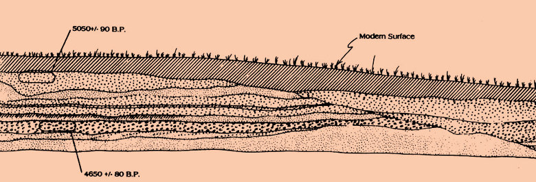
A geological profile from the west end of the Mitchell Ridge site shows that the core of Galveston Island was formed by deposits of fine sand and shell hash (pulverized seashells). These sediments were piled up by wave action and long-shore drift and then reworked and spread across the developing island by storm surges. Two radiocarbon dates obtained from samples of shell hash seem to show a stratigraphic reversal (the older date should be that from the lower deposit). This, however, is easily explained - some of the shells pulverized by wave action were from reworked older deposits. All of the human occupation of the site is found in the uppermost deposit, a fine cumulic (gradually accumulating) sandy soil some 40-60 centimeters (16-24 inches) in thickness. Adapted from Ricklis 1994, Figure 2.2. Enlarge to see legend.
|
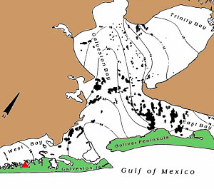
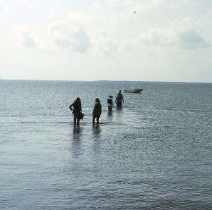
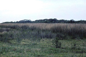
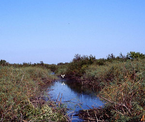
Galveston Bay Area EcologyGalveston Bay and its associated secondary bays and lagoons comprise an extensive and highly productive estuary environment. It is an example of the kind of low relief, protected estuary systems that are among the most biotically productive environments in the world, rivaled only by tropical rainforests. Galveston Bay waters are shallow and characterized by high photosynthetic primary productivity. In essence, sun + sheltered warm water + nutrients = fertile growth of plants and animals all the way up the food chain, as those who harvest Galveston Bay's oysters, shrimp, crabs, and fish today can well attest. The barriers of Galveston Island and Bolivar Peninsula protect the estuary environment from high energy wave action from the Gulf, and maintain moderate salinities. The shallow bays provide excellent habitat for grass beds and salt marshes. The freshwater rivers and bayous that empty into the bays bring nutrients and organic material and support brackish marshes. The wetland marshes and grass beds serve as nursery areas for primary consumers, such as shrimp, crabs, and mollusks. These creatures in turn support a range of secondary consumers such as fin fish, including the species which were used most heavily by native peoples such as black and red drum. The organic debris and nutrients from the marshes, grasses, and the Trinity and San Jacinto Rivers results in Galveston Bay having the most abundant supply of commercial shellfish on the Texas coast—oysters. Reefs of the American oyster (Crassostrea virginica) are large and abundant in Galveston and East Bays and somewhat less so in West Bay due to higher salinity. They are absent in the upper bays, such as Trinity Bay, because of the influx of freshwater. The brackish water clam, Rangia cuneata, is today found in the uppermost bays and along the lower rivers, streams, and bayous where relatively low salinity predominates. The presence of sizeable shell middens (piles of food debris comprised mainly of discarded shells) throughout the Galveston Bay area shows that native peoples made heavy use of both oyster and rangia. Individual middens are usually dominated by one species or the other, reflecting nearby water conditions at the time of occupation. The most economically important fin fish species to native peoples appears to have been black drum, red drum (redfish), sheepshead, and trout, in about that order. The drum spawn in the cool seasons from fall (redfish) to winter and early spring (black drum) when they are concentrated in the bays and tidal passes. Both species of drum grow quite large, with adults weighing 5-10 pounds and more. The bays support large numbers of waterfowl, particularly in the cooler months when ducks, geese, and cranes migrate from the north. Based on the animal bones found at archeological sites, native peoples in the Galveston Bay area did not depend heavily on waterfowl. Terrestrial (land) environments in the Galveston Bay area can be divided into three distinct zones: the coastal prairies, the riverine floodplains and deltas, and the barrier islands. The prairies are low and flat and have heavy clay soils that originally supported savannas (grasslands with patches of brush and trees) dominated by coastal prairie grasses such as big bluestem and indiangrass. Coastal bluestem grass is more common in sandy areas along the mainline shores. The coastal prairies supported numerous mammals, including four species heavily hunted by native peoples: white-tailed deer, eastern cottontail, jackrabbit, and, sometimes, bison. The floodplains of the major streams such as the San Jacinto and Trinity Rivers are biotically rich and diverse. River valleys support dense woodlands and forests of water oak, cedar elm, and sugarberry (commonly called hackberry). Oak-pine forests are found on higher terraces. The low-lying floodplains are lined with rushes, cattails, and willows. Swampy areas support bald cypress and palmetto palm. The riverine floodplains and deltas support all sorts of animals from deer to river otters to alligators to freshwater and brackish water fishes and shellfish. Until modern times, the barrier islands (including Bolivar Peninsula, which although connected to the mainland, is effectively a barrier island) were essentially treeless, except for small mottes of live oak and clumps of mesquite scattered along the higher ridges. Most trees were typically swept away during major hurricanes. The few spots with prominent trees served as navigation markers. Most vegetation consisted of salt-tolerant grasses such as cordgrass and glasswort.
Early 19th century visitors found Galveston Island to be teeming with life. Relatively few mammals inhabited the island, the most common being the hispid cotton rat, but deer were also present in periods between major hurricanes. Freshwater and brackish ponds formed in the mid-island swales and were lined by cattails and marsh grasses. These held frogs, crabs, turtles, water moccasins, and alligators. The ponds allowed dense clouds of mosquitoes to form in warm, wet weather. Amid the thick grasses were many snakes including rattlesnakes. Archeological and ethnohistorical evidence shows that the native peoples who buried their dead at Mitchell Ridge had a mobile lifestyle and probably lived on Galveston Island only during certain seasons of the year. Within a few hours travel by canoe and foot, however, they had access to contrasting environments and diverse resources from the bays, marshes, rivers, and prairies. |
|