Texas Beyond History
TBH Home
Frontier Forts Main

Battles for the Nueces Strip

"Saving the Lieutenant's Hair."
"Saving the Lieutenant's Hair." During an attack on a party of Indians on the Pecos River on April 25, 1875, Lt. John Bullis was rescued by three of his Seminole Negro scouts. For their brave actions, the three—Sgt. John Ward, Pvt. Pompey Factor, and bugler Isaac Payne—were awarded the Medal of Honor. Painting by Dale Gallon, courtesy Gallon Historical Art, Gettysburg, PA (http://www.gallon.com/).

Nowhere in Texas was the army's mission more complex than on the Rio Grande frontier.

Kickapoo
"Quicapú," or Kickapoo, by Lino Sanchez y Tapia, circa 1828. The Kickapoo Indians, along with Lipan Apaches, raided north across the Rio Grande into Texas while Comanche and Kiowa swept down from the Plains to raid into Mexico. Image courtesy of the Gilcrease Museum, Tulsa.
U.S. Army Dragoons
U.S. Army infantry and dragoon (right) during the Mexican War. Units of the dragoons later served on the early Texas frontier at Forts Clark, McKavett, and Inge. Watercolor by Henry Alexander Ogden; published by U.S. Quartermaster General, 1890.
Powder magazine
Powder magazine at Fort Duncan. The fort was established in 1849 near the old Rio Grande crossing known as El Paso de Águila, so named for the flights of eagles seen along the wooded river banks. The town today is Eagle Pass. Photo by Steve Dial.
Comanche trails map
Whether hunting or raiding, the Comanches wore paths from the northern Plains through Texas and into Mexico. Dependable water holes—including Las Moras springs, where Fort Clark was to be sited in 1852—were a critical factor in their routes. Map adapted from Weber, 1982.
Castroville
"Vue de Castroville." The small hamlet 30 miles west of San Antonio was settled in the early 1840s by German, French, and Alsatian emigrants who were promised a land of "milk and honey" on the Texas frontier. Image courtesy of the Texas State Library and Archives Commission.

During the 10 years after the battle of San Jacinto, the fledgling Republic of Texas was scarcely able to keep Mexican soldiers beyond its border or raiding Indians out of its settlements. Annexation to the United States made Texas frontier vulnerabilities the problem and responsibility of the U.S. Army. This was everywhere a daunting and frequently thankless task, but nowhere was the army's mission more complex than on the Rio Grande frontier.

The stretch of the Rio Grande from modern Del Rio to the Gulf of Mexico presented unique military issues. The army's primary mission there was to enforce on the ground a national boundary that was still largely a theory drawn on a map. Local tensions flared into cross-border violence as a new Anglo-American legal system was imposed on Spanish-Mexican traditions. Lipan Apache and Kickapoo raided north of the border from their refuges in Mexico. Comanche and Kiowa swept down from the Plains to raid villages south of the river. The region would be a military and diplomatic headache for the United States government throughout the 19th Century.

In the mid-1700s, the area had evolved as an extension of the northern Mexican cattle culture, the domain of the vaquero. Colonel José de Escandón began moving colonists from the interior of Mexico to the Rio Grande in 1748. Within a year, he had laid out the townships of Reynosa and Camargo on the south bank of the river in its lower valley. Revilla was established in 1750, Mier in 1753. Two years later, Laredo was planted on the north bank, making it an exception among the 20 towns Escandón developed.

By the end of the century, Indian raids from the north and west were terrorizing the ranchos and villages Escandón had established. In 1771, Comanches drove the settlers at Laredo from the north bank to the south bank, where the town of Nuevo Laredo was established. The next year, King Charles III of Spain ordered that all missions and presidios in Texas, except those at Béjar (San Antonio) and La Bahía (Goliad), be abandoned.

It was just this problem that Anglo empresarios were recruited to solve, through the creation of "buffer" settlements or, at least, alternative targets for the Indians. It was a scheme launched in desperation, and the new nation of Mexico maintained it, even as control of Texas slipped into Anglo hands. Mexico soon had two hostile forces assaulting its northern frontier. But the continuing dispute with the Anglos was a mere abstraction for many residents of Mexico who were more concerned with the Comanche threat. By the mid-1840s, Comanches were reported raiding in Zacatecas, nearly 500 miles below the border, and at Querétaro, less than 150 miles from Mexico City.

The U.S. Army arrived on the Rio Grande in 1846, shortly after Texas was annexed to the United States. General Zachary Taylor's "army of observation" was stationed first at Corpus Christi, then moved to the valley of the lower Rio Grande. War with Mexico soon followed, and the army established Fort Brown near the mouth of the river. Supplies for Taylor's invasion force were shipped upstream, where steamboats took on fuel at a private dock known as Davis' Landing. By war's end, the army's presence in the valley had attracted considerable Anglo commerce and settlement. Fort Brown spawned the town of Brownsville. Davis' Landing became Rio Grande City.

An army post established in 1848 at Davis' Landing was named Ringgold Barracks and, 30 years later, Fort Ringgold. Fort McIntosh was established upriver at Laredo in 1849. Unsettled social and political conditions in Mexico, and the diplomatic intrigue which accompanied two world wars, would keep all three of the valley forts in operation until the 1940s, with Forts Brown and McIntosh surviving as military posts until after World War II.

The international issues were difficult enough in the lower Rio Grande valley, but the army's task was even more formidable upriver from Laredo. The term, "Nueces Strip," describes that portion of the area between the Rio Grande and the Nueces where the two rivers flow parallel to each other before the Nueces makes a bend to the east. The roads from the old Presidio de San Juan Bautista crossed into Texas through this region, and the Mexican General Adrian Woll passed this way with his invasion force that seized San Antonio in 1842. It also was a region through which settlers were attacked by Indians from all directions.

One of the Comanches' favored travel routes reached the Rio Grande by way of Las Moras Creek, fed by prolific springs near the low hills east of modern Del Rio. Some sources indicate that once south of the Rio Grande, the Comanche trail proceeded southeasterly—parallel to the river—for hundreds of miles through the Mexican state of Tamaulipas. Another branch of this trail skirted the interior cities of Monclova, Monterrey, and Saltillo.

The Treaty of Guadalupe Hidalgo set the terms by which the United States and Mexico ended nearly three years of war in 1848. The treaty required that the United States keep its Indians—both the Comanche and their Kiowa allies—from raiding in Mexico.

Below the point where Las Moras Creek flows into the Rio Grande, and above Laredo, was a crossing of the river known as El Paso del Águila. The army in 1849 established a post a short distance above the crossing. Initially called Rio Grande Station, it was subsequently named Fort Duncan. With the inevitable arrival of Anglo traders, a town site was laid out near the post. The village became known as "Eagle Pass."

Two weeks before Fort Duncan was established, the army located a post on the Leona River between the Rio Grande and San Antonio. Soon to be named Fort Inge, it would be on a line of posts extending southwesterly from the Red River through Henri Castro's Alsatian colony west of San Antonio.

Nueces Strip
In land nearly barren after years of grazing, the Nueces Strip—stretching from the Rio Grande to the Nueces River—offers little in the way of cover except the gray-leaved cenízo, Texas prickly pear, tasajillo, and the thorny brush: mesquite, agarito, granjeño, huisache, and catclaw. Photo by Susan Dial.

Click images to enlarge

Map of Spanish land grants
Map of Spanish land grants between the Rio Grande and Nueces rivers. Spanish "ranchos" on both sides of the river in the late 1700s were prime targets for Indian raids. Based on Texas General Land office map and adapted from Jackson, 1986.
Spanish Colonial rancho
Ruins of a Spanish Colonial rancho in Zapata county, across the Rio Grande from the settlement of Revilla. Early ranchers built strong compounds as a protection against Indians in the late 18th and early 19th century. Photo by Jack Hughes, 1950, TARL Archives.
frontier before 1855
U.S. Army posts and settlements on the Rio Grande frontier before 1855.
oxcart
Hauling firewood in oxcart, south Texas. Photo from TARL Archives.
Las Moras creek
Las Moras creek near Fort Clark. One of the Comanches' favored travel routes reached the Rio Grande by way of the heavily wooded, spring-fed stream. Photo by Susan Dial.
Henri Castro
Empresario Henri Castro, founder of Castroville and other small "buffer" settlements, struggled for years to settle land claims with the Texas government, in spite of his success in bringing European settlers to the Texas frontier.
Nueces River
The broad, clear Nueces River flows southward and parallel to the Rio Grande, outlining the once-treacherous area known as the "Nueces Strip." Photo by Susan Dial.
US Army posts after 1855
U.S. Army posts and towns of the Rio Grande frontier after 1855.
"Texan settlers pursuing Indians"
"Texan settlers pursuing Indians." Engraving and story from New York Illustrated News, March 13, 1861. Courtesy Texas State Library and Archives Commission. Click to enlarge and read news account by correspondent reporting from Roma, Texas..
Hills east of the Nueces
Hills east of the Nueces rise above the thick growth of juniper, cenízo, and mesquite, leafless during winter months. Photo by Susan Dial.
"Rip" Ford
John S. "Rip" Ford. As a captain of Texas rangers, Ford played a critical role in protecting the south Texas frontier.
Lt. John L. Bullis, commander of a company of the 41st Infantry at Fort Clark, went on to become legendary as a leader of the Seminole-Negro Indian scouts. Photo courtesy Lawrence Jones III. View large image.
early travelers
Early travelers on a packed stage pause for refreshment during their journey on the south Texas frontier. Image courtesy Kinney County Historical Society.

The Nueces Strip marked the confluence of the army's first two frontier assignments in Texas: maintaining the integrity of the nation's new southern border and defending the western settlements from Indian attack. Together, Forts Duncan, Inge, and McIntosh gave the army a significant presence in the region. But whatever its contribution to international diplomacy, that presence was inadequate to keep Indians away from the settlements, on either side of the Rio Grande.

The army's problem there was not exclusively, or even primarily, with Comanches and Kiowas. The Lipan Apaches had been pushed off the High Plains by the Comanche, then off the Edwards Plateau. As if caught between a hammer and anvil, they had been pummeled by the troops of Spanish Colonel Juan de Ugalde in the canyon of the Sabinal River. In the mid-1800s, they still lurked in the canyons of the Balcones Escarpment and raided settlements and travelers from Laredo to San Antonio. When pursued, they escaped to Mexico.

The Lipan had a checkered relationship with Anglo-Texans. Dedicated enemies of the Comanche, they fought them as scouts and warriors in the service of John Henry Moore and John Coffee Hays' rangers. But when not enlisted to fight Comanches, they preyed on the ranchos of the Nueces Strip and the farmsteads of the Hill Country.

The recently arrived Kickapoos would be almost as troublesome. Originating in the northern Great Lakes region, they had moved south in response to pressure from white settlers, and the Spanish had offered them land with the Cherokee in northeast Texas. Both tribes were attacked by Texas troops in 1839, and some of the Kickapoo escaped to Mexico. They accepted a grant of land from the Mexican government and raided Texas settlers from villages south of the Rio Grande.

Until the mid-1850s, most of the U.S. Army's energies in Texas were directed at constructing new forts and pacifying the brush country south of the Nueces River. Texas civilian forces, sometimes denominated "mounted volunteers" and sometimes "rangers," frequently were enlisted as auxiliary troops for the army. In 1850, 10 companies of the Army's 2nd Dragoons and 1st Infantry commanded by Captain William J. Hardee, assisted by rangers under William "Bigfoot" Wallace, conducted a sweep of the Nueces Strip that produced four engagements with hostile Indians.

By the time of Hardee's campaign, it had become apparent that the army lacked sufficient resources for its mission in southern Texas. Comanche raiders struck ranches north of Corpus Christi in 1849, and a similar raid through Refugio and Castroville in 1850 netted the Indians an estimated 400 horses. Finding its Rio Grande forts inadequate to protect the region, the Army placed posts along the Nueces—Fort Merrill, established in 1850 about 40 miles northwest of Corpus Christi, and Fort Ewell, added in 1852 at the crossing of the Nueces between Laredo and San Antonio.

Discovery of gold in California in 1848 resulted in yet another mission for the army, that of defending the southern transcontinental travel route from San Antonio to El Paso. In 1849, Lieutenants W.H.C. Whiting and William F. Smith of the army's Corps of Topographical Engineers returned to San Antonio from El Paso by way of the Devil's River, the Nueces, and the Leona, guided by veteran frontiersman Henry Skillman. This route became known as the "government" road, and within a few years Skillman was using it for a mail and passenger coach service between San Antonio and El Paso.

The army began revising its western defense strategy in 1852. New posts a hundred miles beyond the frontier settlements replaced the interior forts. One, soon to be named Fort Clark, was positioned at Las Moras Springs near the intersection of the government road and the Comanche's old eastern raiding trail. With aggressive patrolling by the Army's Mounted Rifles and John S. "Rip" Ford's rangers, Indian raids in south Texas began to diminish. Fort Ewell was abandoned in 1854, and Fort Merrill followed in 1855.

The 2nd Dragoons were transferred to Kansas in 1855, but replacements arrived early the next year in the form of the new 2nd Cavalry. The regiment included 16 future Civil War generals in its officer corps, including Colonel Albert Sidney Johnston, Lieutenant Colonel Robert E. Lee, and Hardee, now a major with a reputation as a vigorous Indian fighter. In 1857, companies of the 2nd Cavalry from Forts Clark, Inge, and McIntosh fought 10 engagements, the greatest number of actions against hostile Indians in south Texas by any U.S. Army regiment during the entire pre-Civil War period.

Encampment on the Leona
Encampment on the Leona, Texas, 90 miles west of San Antonio, May 13, 1849, near the future site of Fort Inge. Sketch by Capt. Seth Eastman, courtesy Marion Koogler McNay Art Museum.
William J. Hardee
William J. Hardee, renowned Indian fighter and one of 16 officers who served on the Texas frontier with the 2nd Cavalry and later attained the rank of general during the Civil War. Photo courtesy Library of Congress.
Kiowa man
An 1875 drawing by a Kiowa Indian depicts a Kiowa man, "Zotom," taking a Mexican wagon train. Drawing by Kiowa (Koba), Fort Marion, Florida, 1875. Image courtesy of National Anthropological Archives, Smithsonian Institution. Click for enlargement, more information.
Fort Brown
Detail of photograph of Fort Brown, Brownsville , Texas, circa 1916. Shown is the hospital building. Courtesy of the Center for American History, University of Texas at Austin, Runyon Collection. Click to see full image.
Ft. Clark
Army wagon at Fort Clark, circa 1885. Photo courtesy of Fort Clark Historical Society.
Sargent hotel
Sargent hotel and stage stop in Brackettville. One guest of the hotel in the 1870s described the town as "the liveliest burg in west Texas, where the night life could be compared only to the saloons and gambling places…of California and the Klondike." Photo by Susan Dial.
Chalk Bluff
Chalk Bluff roadside marker
Along with raids by bandits, Indian attacks continued to plague settlers in the Nueces Strip, particularly during the Civil War years. In May of 1861, two of the state's well-known Indian fighters were ambushed and killed by a band of 20 Indians near Chalk Bluff on the Nueces River. Photos by Susan Dial.
frontier after Civil War
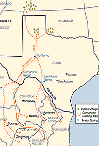
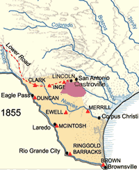
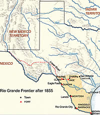
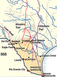
U.S. forts and settlements in the Rio Grande frontier after the Civil War. Cattle trails from south Texas to markets in the north mark the development of the cattle industry.
Mexican cowboys
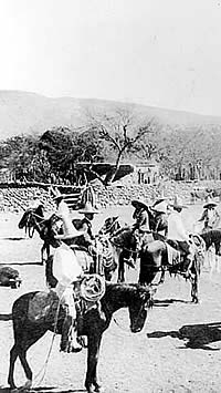
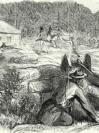
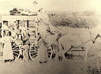
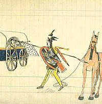
Mexican cowboys branding cattle in south Texas. The rise of the cattle industry after the Civil War spurred raids and rustling by Indians and bandits. Courtesy Texas State Library and Archives Commission.
Ft. Inge
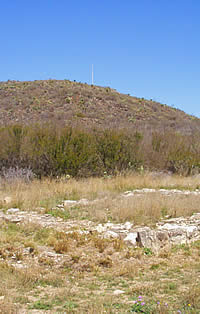
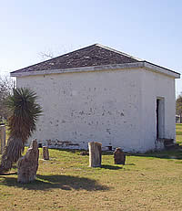
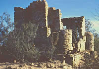
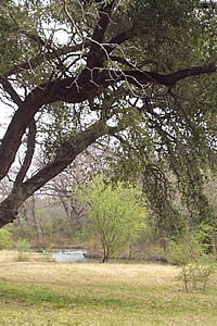
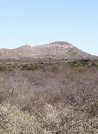
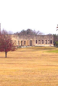
Ruins of structural foundation at Fort Inge with Inge Hill in the distance. Photo by Susan Dial.
Texas longhorn
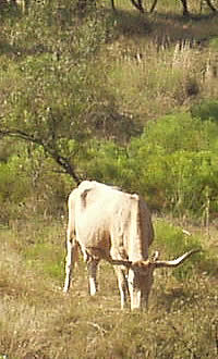
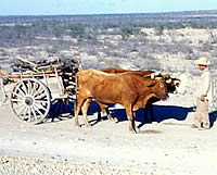
Texas longhorn. After the Civil War, thousands of wild longhorn cattle were driven up trails to high-paying markets in the north. Photo by Susan Dial.
yucca
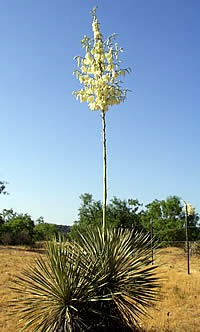
Yucca in bloom in south Texas. Photo by Susan Dial.
"The Mikado"
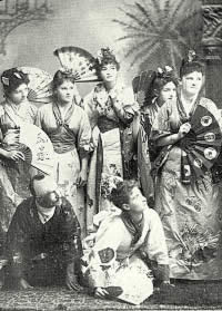
Fort Clark entertainment, 1887. Costumed officer and wives shown performing the Gilbert and Sullivan operetta, "The Mikado." Photo, Vinton Trust.
Ft. Clark today
Fort Clark today. The post has become a private resort, with the old parade ground now used as a golf course. Photo by Susan Dial.

United States troops vacated all of the Texas forts when the state seceded. "Rip" Ford's Texas Mounted Rifles were primarily responsible for defense of the border against Indians, Mexicans, and United States forces early in the Civil War, and Ford returned to the Rio Grande late in the conflict to participate in its last battle.

The border posts were the first to be reoccupied by the U.S. Army after the war ended. The army had some 40,000 soldiers in the state by the fall of 1865, most located either among the population centers to assist in Reconstruction duties or on the Rio Grande to guard against the French who were then occupying Mexico.

Within two years, the wartime volunteer units had mustered out of service, and the remaining regulars numbered 
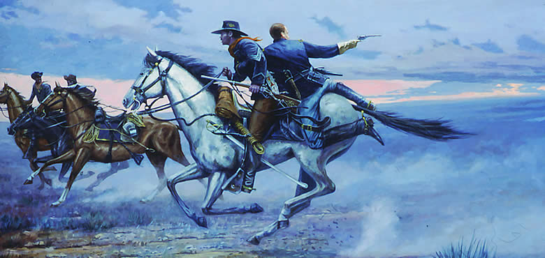
only about 5,000. The units posted to the Rio Grande included the 41st Infantry, a regiment of black enlisted men and white officers. Colonel Ranald Mackenzie located the unit's headquarters at Ringgold Barracks, and by the fall of 1868, the 41st provided garrisons for Fort Clark, Fort Duncan, and Fort Inge. It shared Duncan and Inge with companies of the 9th Cavalry, a regiment also manned by black troopers and white officers.

When Company D of the 41st Infantry arrived at Fort Inge, it was commanded by Lieutenant John L. Bullis. Over the next 15 years, Bullis would become almost legendary on the western frontier for his leadership of the army's Seminole-Negro Indian scouts.

Fort Inge was abandoned in the spring of 1869. The 41st Infantry's headquarters were transferred to Fort McKavett, and the regiment was combined with the 38th Infantry to form a new regiment, the 24th Infantry. From 1870 through 1872, three black units—the 9th Cavalry and the 24th and 25th Infantry—provided the garrisons for Forts Clark and Duncan.

By the mid-1870s, increased traffic and commerce had combined with the rapid development of a cattle industry to make the Nueces Strip a target-rich environment for Indians and outlaws from both sides of the Rio Grande. The army's pre-Civil War supply system had been instrumental in developing 
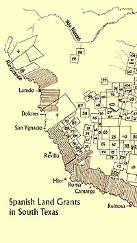
wagon roads between Corpus Christi and Laredo (Fort McIntosh), Laredo and Fort Duncan, and San Antonio and Fort Clark. New communities had grown up near the forts—Brackett (or Brackettville) near Fort Clark, Uvalde (an anglicized tribute to the Spanish soldier Ugalde) near Fort Inge, and Eagle Pass near Fort Duncan. They furnished materials and civilian labor for army construction projects and served as supply centers for the ranches that began to grow up in the region.

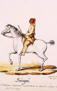
Spanish-Mexican cattle roamed wild by the hundreds of thousands in south Texas after the Civil War. Locally, they were worth as little as $2 per head, but on the northern markets they brought $40 or more. Development of a system to reach those markets set off an "open season" of cow hunting in the brush country. Rustling and trafficking in stolen livestock became profitable enterprises.

In 1875, a gang of about 30 outlaws terrorized travelers and residents in and around Corpus Christi. A wounded member of the band told his captors that the gang had come from south of the Rio Grande in several smaller groups, and had rendezvoused near the town with the intention of sacking it completely. Texas Governor Richard Coke immediately directed Leander McNelly, captain of a special company of rangers, to deal with problems on the border.

As matters developed, international banditry was beyond the effective control of state forces. The situation ultimately improved only because of a series of U.S. Army incursions into Mexico that could have provoked open warfare between the two nations. The first of these expeditions, in the summer of 1876 and fall of 1877, were directed by "Pecos Bill" Shafter, commander at Fort Duncan. Shafter relied primarily on 10th Cavalry troopers—the original "buffalo soldiers"—and Bullis's Seminole-Negro Indian scouts, supported by detachments of 24th and 25th Infantry. Several attacks were made on Lipan or Kickapoo camps, most with some degree of success.

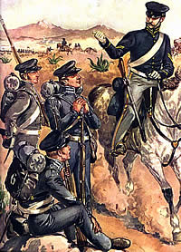
Mexican authorities protested, but took no action until Mackenzie led a larger expedition across the Rio Grande in 1878. The effort was notable mainly for the confrontation it produced with a Mexican army. Conflict was avoided, however, and the affair prompted Mexico to keep a stronger military presence near the border that helped suppress raiding in Texas.

Brackettville became the county seat of Kinney 
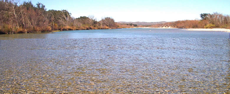
County when it was organized in 1876. To the west, an agricultural development sprung up around irrigation canals fed by San Felipe Springs. The small town, San Felipe del Rio, received a post office in 1883, shortened its name to Del Rio, and became the county seat of Val Verde County in 1885.

Revolutionary activity in Mexico spilled over the border into Texas after 1910, and the U.S. Army sent forces across the Rio Grande in 1916. Although troops from Fort Clark and Fort Duncan were not directly involved in the operation, the political unrest provided sufficient reason for the army to maintain its presence all along the international boundary. Soon, the United States was preparing to enter World War I, and both Fort Clark and Fort Duncan received a new lease on life. Duncan became a training facility, and had 16,000 soldiers on post in 1916.

At war's end, however, the futures of the two forts were set on different paths. The army abandoned Fort Duncan in 1927. The City of Eagle Pass began maintaining the property, and in 1935 turned it into a park. With the onset of World War II, the army accepted use of the property for an officers club and swimming pool for personnel of the Eagle Pass Army Airfield. The property has since reverted to historic status. Seven of the original buildings remain, and the former post headquarters houses a museum.

Fort Clark became home to the Fifth Cavalry and was refurbished in the 1930s. The post entered its twilight years as another world war approached. Its troopers participated in cavalry war games near Marfa in 1936. Its last regular garrison went to war in 1944, and the fort became a camp for German prisoners of war. The army abandoned Fort Clark in 1946 and sold it for salvage. The property was operated as a corporate retreat until 1971, when it became a residential development. Most of the buildings have been converted to private use. The Fort Clark Historical Society maintains a museum in the former post guardhouse.


Fort Inge
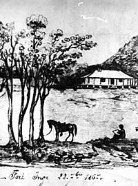
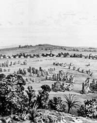
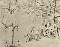
Detail of Fort Inge, drawn in 1867, shortly before it was to be abandoned. The brush-covered shelters, or "ramadas," on right, shelter the tents of black soldiers posted there after the Civil War. U.S. flag flies atop the basaltic hill known as Pilot's Knob. Courtesy National Archives.
Turkey buzzards
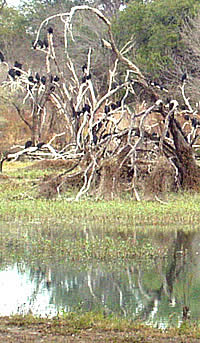
Buzzards roosting above Las Moras creek at Fort Clark. Photo by Susan Dial.
Fort Ringgold Barracks
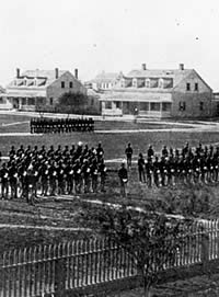
Drill at Fort Ringgold, Rio Grande City, circa 1886. Like several of the border posts, Fort Ringgold (formerly called Ringgold Barracks) was to remain in operation until after World War II. Photo from Crimmins Collection, Center for American History, UT-Austin (CN# 02717).
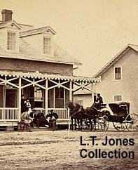
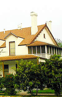
Officers quarters at Fort Brown. Photo courtesy of Lawrence Jones, III. View large image.
dance card
Dance card from an 1884 Leap Year "Hop" at Fort Clark. Dances, plays, and musical evenings provided social opportunities and entertainment at the post, particularly in later years. Fort Clark Museum.
Ft. McIntosh
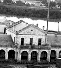
Once used as accommodations for soldiers, this and other structures at Fort McIntosh now house Laredo Community College. Photo by Mary Black.