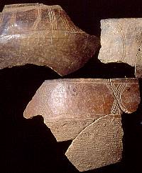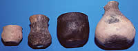
Late Caddo period Avery Engraved
bowl from Foster site, Miller County, Arkansas. From
C.B. Moore, 1912.
Click images to enlarge
|
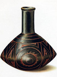
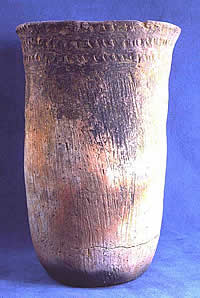
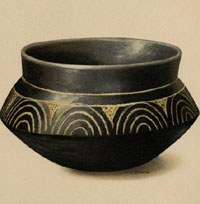
Late Caddo period Belcher Engraved
bottle from Foster site, Miller County, Arkansas. From
C.B. Moore, 1912.
|
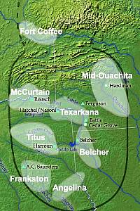
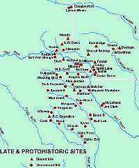
Approximate extent of some of the
phases archeologists have defined for the early 1500s
Late Caddo world. (The people responsible for the Fort
Coffee phase in the Arkansas Basin may not have spoken
Caddo.) Some of the Late Caddo sites mentioned in the
text are also shown. Adapted from Perttula, 2000, and
other sources.
|
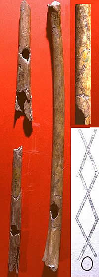
Stone tools from Late Caddo site
in northwest Louisiana. Courtesy Tim Perttula.
|
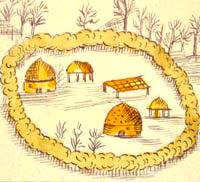
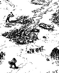
This detail from the famous Terán
map shows a hedge-ringed compound or farmstead where
an extended family probably lived. There are two houses,
two raised granaries, and a ramada (shade arbor).
|
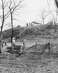
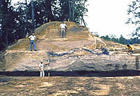
Hatchel Mound as it appeared in 1938
when WPA crews began excavations. This is thought to
be the "templo" mound depicted on the Terán
map. TARL archives.
|
Low mound at the Eli Moore site on
the Red River west of Texarkana that is thought to have
been part of the Upper Nasoni village depicted on the
Terán map. Texarkana phase, Late Caddo period.
Photo courtesy Tim Perttula.
|
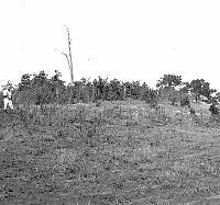
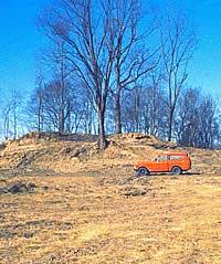
The "Ash Mound" at the
Frankston phase A.C. Saunders site in 1931 prior to
initial excavations there by A.T. Jackson from the University
of Texas. TARL archives.
|
|
About 500 years ago, Caddo population reached
an all-time high. Caddo ritual centers, villages, hamlets,
and farmsteads existed in all but a few areas of the Caddo
Homeland, such as parts of the middle Sabine Valley and upper Sulphur River basin. Such areas had
been settled earlier and may have been abandoned because of
localized climatic conditions, declining soil fertility, or,
more likely, because they fell between the territories of
rival groups. Early Spanish accounts make it clear that the
Caddo world was made up of small competing societies (polities)
who were never politically united. Instead, various groups
formed alliances and friendship pacts to protect their own
territories, provide access to trade routes and scarce resources,
and to join forces to fight enemies. Lists of enemies complied
by the Spanish show that Caddo groups sometimes counted other
Caddo groups among their enemies. This fluid world of small
competing societies and shifting alliances seems to fit well
the archeological evidence of the Late Caddo period (ca.
A.D. 1400-1680).
The ending date for the Late Caddo period of
A.D. 1680 is chosen because soon thereafter the European invasion
began to cause major, irreparable changes to Caddo societies.
Archeologists sometimes use the term protohistoric to refer
to the period after the first contact with European culture
and before the period of sustained interaction. In the case
of the Caddo, the first contact was with DeSoto's army in
1542-1543, but it would be another 143 years (A.D. 1686) before
Europeans returned to the area. In the intervening protohistoric
period, European diseases, horses, Old World plants,
and trade goods likely began to reach some Caddo groups. But the
real impact of these European introductions did not take hold
until the late 1600s.
It is during the period between about A.D. 1400
and A.D. 1680 that we see the greatest number of distinct
geographical clusters (territories) across much of the Caddo
Homeland. These are relatively small areas about 60-100 miles
long and 25-50 miles wide within which we find similar Late
Caddo pottery styles and other ways of doing things. Archeologists
call these geographic clusters phases and they probably
each represent the combined territory of several allied groups
that intermarried and shared close ritual, economic, social, and military
ties. The accompanying maps show some of the phases that have
been defined, but you should realize that these are just approximations
that are only as accurate as the field information. In areas
that have seen lots of archeological work, such as much of
northeast Texas, the phases are reasonably well known. For
many other areas, they are not.
In the Great Bend area of the Red River, Caddo
archeological sites dating after ca. A.D. 1400 are included
in the contemporaneous Belcher and Texarkana phases. Texarkana
phase sites occur on the Red River northwest of Texarkana
to the Arkansas/Oklahoma state lines, as well as on the lower
Sulphur River. Belcher phase sites (ca. A.D. 1500 to
the late 1600s) are distributed from about Fulton, Arkansas,
to below Shreveport, Louisiana. Upstream from the Texarkana
phase, the McCurtain phase represents another distinct
Late Caddo cluster of related sites in northeast Texas and southeast Oklahoma.
In the Texarkana and Belcher phase areas, sites
include large, permanent settlements with mounds and cemeteries,
hamlets, and farmsteads. The mound centers were marked by
the construction of earthen mounds that were used as temples,
burial mounds, or ceremonial fire mounds. These settlements
were inhabited by sedentary Caddo agricultural communities
with complex societies led by individuals with high status
who lived at the mound centers. Mound centers such as Belcher,
Battle, Hatchel, and Cabe represent the larger villages or
towns. Hamlets or farmsteads have been investigated at the
Sherwin and Atlanta State Park sites for the Texarkana phase
and the Cedar Grove and Spirit Lake for the Belcher phase.
Both the larger communities and the smaller
hamlets/farmstead had pole and grass structures (usually circular),
outdoor ramadas or arbors (for shade), household cemeteries,
and middens filled with household refuse. The 1691 Terán
de los Ríos map of the Nasoni village on the Red River
documented the likely character of individual farmstead compounds
and the layout of a dispersed village. In northwestern Louisiana,
Belcher phase sites are distributed along Red River channels
and meanders that are no longer active today (the river's
course shifted repeatedly in historic times). Cowhide Bayou
and Red Chute Bayou in the Shreveport area are good examples
of once-active channels along which Late Caddo sites are found.
Texarkana phase sites appear to date from ca.
A.D. 1400-1700, and mound construction seems to coincide with
the main period of settlement at the Hatchel site, from about
A.D. 1400-1700. Both archeological and historical information
suggests that the main platform mound (with many levels of
structures and features) at the Hatchel site may be the templo
or temple mound shown on the 1691 Terán map of the upper Nasoni
village. The Horace Cabe mound may also have been occupied at this
time, as well as the Eli Moores mound site, and the Moore/Higginbotham mound center and community
a few miles downstream from the Horace Cabe site probably represents
the upper Cadohadacho village that was eventually abandoned
in 1788.
Like other Caddo groups on the Red River, the
McCurtain phase settlement pattern includes numerous
habitation sites (with household cemeteries and substantial
midden deposits) and mound centers. The mounds appear to have
mainly been constructed between ca. A.D. 1300-1500. In some
instances, mound centers were not directly associated with
permanent settlements or middens. The McCurtain phase mounds
were generally constructed in one or two stages over important
public structures, with the structure abandoned, dismantled
and/or burned, then capped with a fill zone of soil scraped
from nearby deposits. Simple and elaborate single and multiple
burials were also placed in the mounds, as with the East Mound
at the Sam Kaufman site on the Red River.
Caddo settlements along this stretch of the
Red River seem to closely resemble those depicted in the Terán
map and Soule photograph; Caddo villages were composed of
individual compounds of houses and other structures associated
with mounds and the residence of a caddi or chief. The density
of McCurtain phase sites indicates that greater numbers of
people are living in closer proximity than before. At the
Sam Kaufman site the mound in McCurtain phase times was used as
a place for the burial of the social elite. A shaft tomb containing
10 individuals and many grave goods was found near the center
of the mound, which had been excavated through the remains of a burned temple structure. Special purpose salt-processing sites, such
as the Salt Well Slough site (41RR204) are also common in
the vicinity of the Sam Kaufman site.
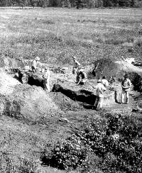
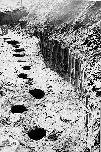
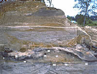
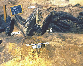
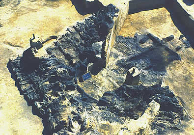
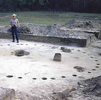
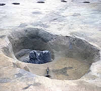
The Frankston phase is comprised of farmsteads,
hamlets, and small villages in the Neches and Angelina river
basins in East Texas that date from ca. A.D. 1400-1680. The
only Frankston phase site known to have mounds is the A. C.
Saunders site. Excavations there in the early 1930s by
crews from the University of Texas led by A. T. Jackson provides
us with a unique glimpse of Late Caddo ritual life. The first mound (Feature 1)
itself was not very high (2.2 meters or 7 feet) but it was
broad covering an area about 26 by 33 meters (85 by 107 feet).
Trenches into it showed that it was made up of thick deposits
of ash capped by a clean layer of sandy loam; very few artifacts were recovered in the excavations there.
|
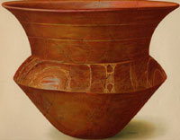
Late Caddo period Belcher Engraved
bowl from Foster site, Miller County, Arkansas. From
C.B. Moore, 1912.
|
Some of the better known and most important sites dating
to Late Caddo and Protohistoric times, about A.D. 1400-1680.
Graphic by Dee Ann Story. |
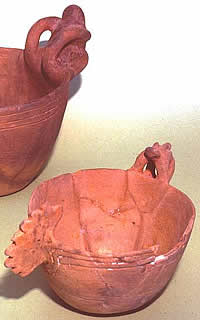
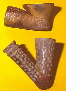
Frankston phase effigy bowls. TARL
archives.
|
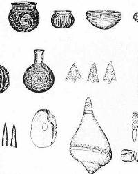
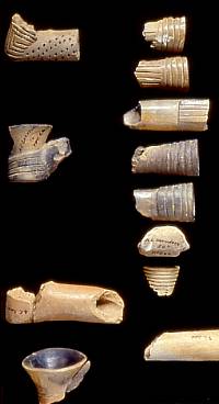
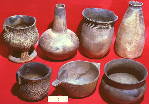
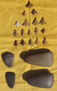
Belcher phase artifact assemblage.
From Webb, 1959.
|
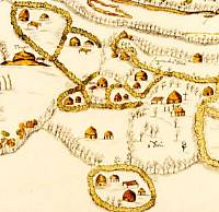
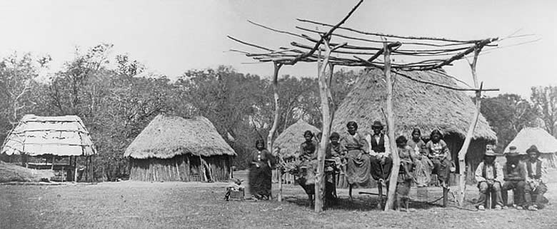
"Terán Map" of Upper
Nasoni settlement on Red River, produced by the Spanish
expedition of 1691-1692, led by Terán del Rio.
This village was part of the Cadohadacho alliance. The
map shows that the community consisted of small farmsteads
or extended family compounds, each depicted as being
surrounded by hedges or rows of trees or bushes. The
settlement shown is believed to have stretched along
several miles of the Red. The "templo" mound
is believed to be the archeological site known as the
Hatchel mound.
|
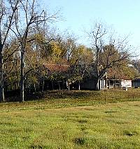
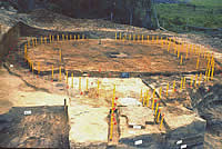
Hatchel Mound as it appears today.
|
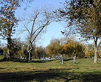
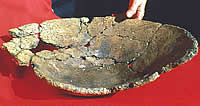
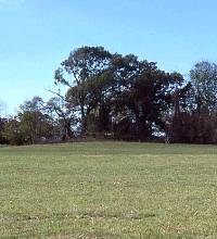
The Cabe Mounds site was one of the
major ritual centers along the Red River during the
Texarkana phase and probably represents part of the
upper Cadohadacho village that was eventually abandoned
in 1788.
|
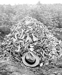
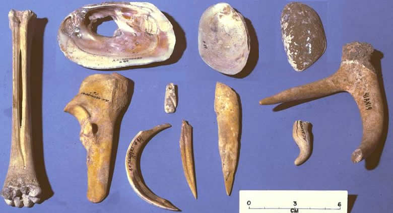
Animal bones (mostly deer) from 1930s
excavation of a Frankston phase midden at the A.C. Saunders
site in the Neches Valley of northeast Texas.
|
|