Los Adaes: 18th-Century Capital of Spanish Texas
|
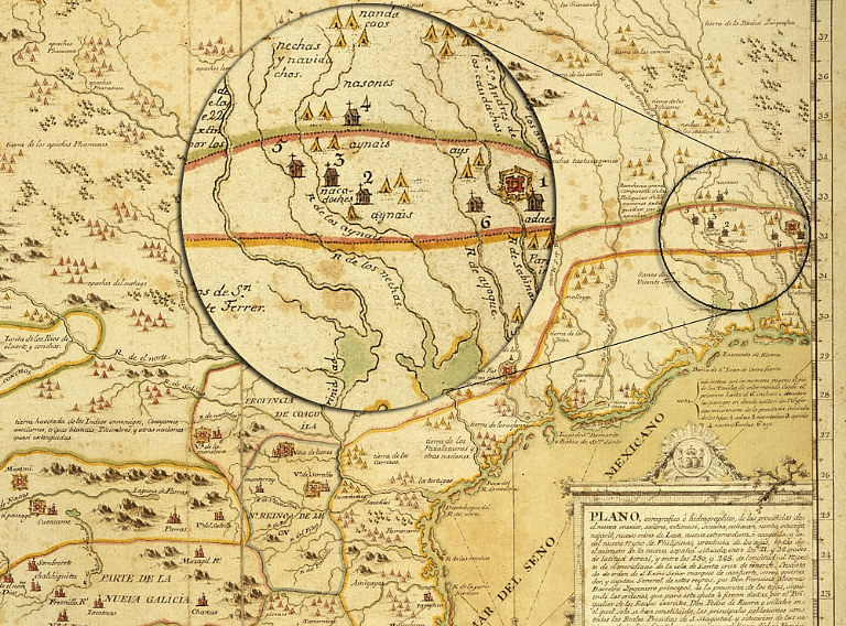
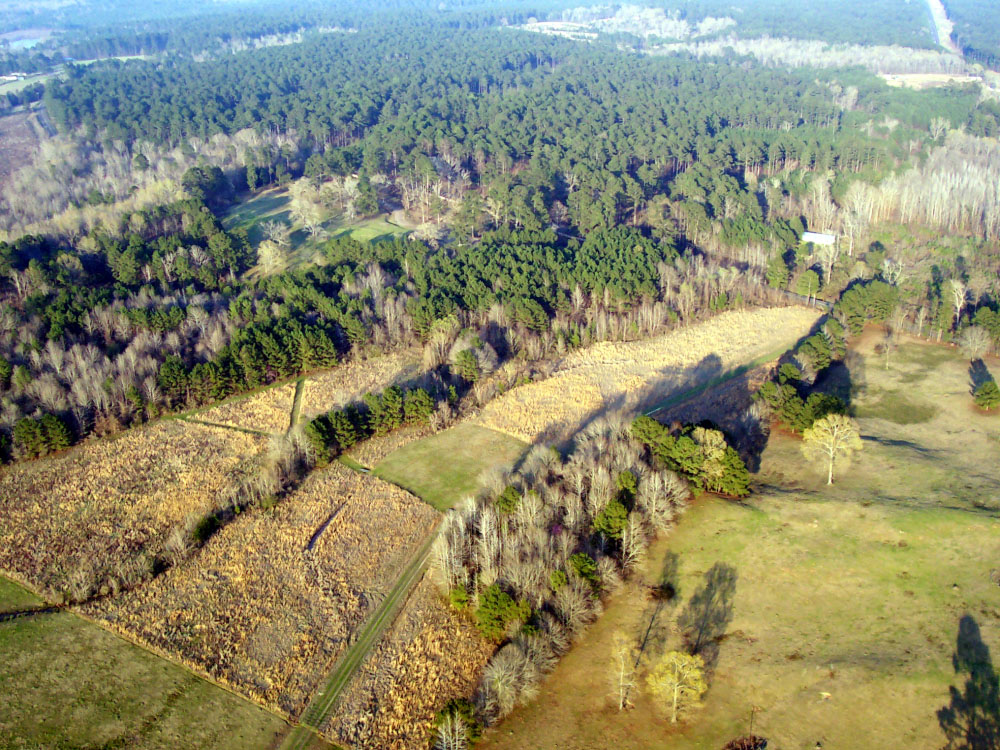
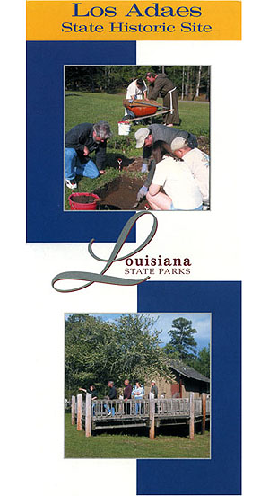
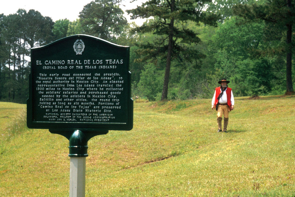
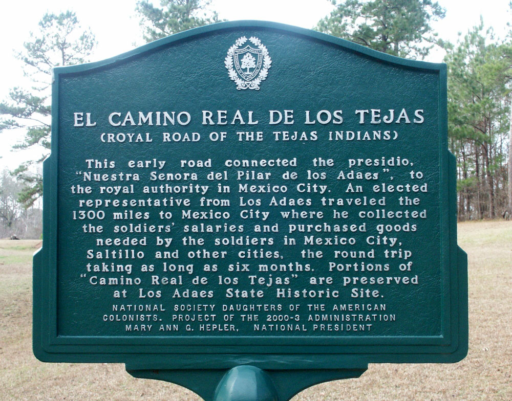
Thirty miles east of the Sabine River in northwestern Louisiana lie the ruins of one of the first capitals of Texas, a fact little known to most people today. Yet from 1729 to 1770, Los Adaes served as the official capital of the Spanish province of Tejas on the northeastern frontier of New Spain. Part presidio (fort) and part mission, this outpost was intended to keep the French out of New Spain and to bring Christianity to the Caddo Indians and their neighbors. Although Los Adaes didn't really succeed in doing either, the remote provincial capital slowly grew to become home to over 400 Spanish citizens, including many families, some soldiers, and a few priests, as well as converted Indians, French traders, escaped slaves, and other frontier denizens. The curious story of Los Adaes is quite unlike that of any other place, a dynamic consequence of location, three contrasting cultures, and a transitional time in the history of the New World. Los Adaes may well be the only Spanish Colonial provincial capital left on earth that is essentially intact, at least from an archeological perspective. All the other capitals, such as San Antonio, Texas, Sante Fe, New Mexico, and Saltillo, Mexico, to name only three, became towns and cities that are still populated today. In these well-known cities, most traces of their early history as Spanish provincial capitals have been built over, cut through, dug up, and otherwise destroyed or transformed into the population centers they are today. Although a few of the more impressive military, religious, or administrative buildings have been preserved at most provincial capitals, these are mere remnants of the original settlements. In contrast, Los Adaes still occupies two adjacent low ridges or "hills" in the lightly populated pine-forests and pastures of northwestern Louisiana. To be sure the Spanish capital's standing architecture, none of it made of stone, disappeared centuries ago as Los Adaes was abandoned and all but forgotten by mankind to be reclaimed by forest. Most travelers today, even on foot, would have no idea what was there except for the fact that Los Adaes is a Louisiana State Historic Site. There a small interpretive center sits near the former presidio, its hexagonal outline traced by landscape timbers. But beneath the ground lie the patterns and distinctive material evidence of the 18th-century capital, traces that archeologists have only begun to explore. Because the state of Louisiana now owns most of the property, this very special place is likely to be preserved and studied bit by bit for centuries to come. During the five decades it survived as an active settlement, Los Adaes occupied what the Spanish regarded as an untamed wilderness, far removed from any Spanish center of commerce and population. For much of that time, Los Adaes was literally the end of the road, at least in the eyes of the Spanish. It was the terminus of a trail bearing the grand and quite misleading title, El Camino Real de los Tejas, the Royal Road of the Tejas (Hasinai Caddo) Indians. This "road" connected Los Adaes, the easternmost outpost of the continuous Spanish New World empire, to Mexico City, the seat of Spanish royal authority in the heartland of New Spain. The nearest major town and supply center was Saltillo, some 800 miles distant, although San Antonio de Béxar grew to become an important population and military center while Los Adaes served as the provincial capital. The paramount reason the Spanish established Los Adaes and made it their provincial capital was to protect the far-flung lands they claimed and thwart the aims of their European competitor, France. In the 18th century (1700s) the French were making concerted efforts to expand their colonial New World empire from the Mississippi River westward into the lands claimed by Spain. Los Adaes was placed a mere 13 miles west of Natchitoches, the French fort and trade center on the Red River established in 1713. Ironically, had it not been for the nearby French, the Spanish would never have been able to survive. They also came to depend on Caddo Indian groups and the closely related Adai tribe, for whom Los Adaes was named. The Spanish settlers became middlemen in the thriving trade between the Caddoan groups and the French, with deer and bison hides, horses, and bear grease bartered to the French in exchange for guns, ammunition, and European trade goods. Such commerce was banned by the Spanish Crown, but repeated attempts to stop the contraband trading failed miserably. In this exhibit you'll learn how historians, archeologists, and anthropologists, among others, are unraveling the still-unfolding story of Los Adaes, the 18th-century capital of Spanish Texas. Like most site exhibits on Texas Beyond History, the Los Adaes exhibit is told in sequential topical sections, each of which stands on its own but collectively forms a narrative. Explore the following sections to learn more. Setting: The Natural World sets the stage for the natural worlds upon and within which the Los Adaes story plays out. Cultural Worlds provides context for the full exhibit. The story of Los Adaes cannot be understood without an appreciation of the overlapping cultural worlds that shaped its history: that of the region's native peoples, the Spanish, and the French. Spanish Capital Through Time is an overview of Los Adaes' history in timeline format with a chronology of key events and periods, from the events leading up to its founding to its 18th-century demise as a capital and role as a unique settlement area of Louisiana. 18th-Century Map Gallery contains images of fourteen maps spanning the 18th century. Collectively, these show what the French, Spanish, and British knew about the physical and cultural geography of the area that is today occupied by Texas and Louisiana. Explore Los Adaes is a special interactive section allowing visitors to explore Los Adaes and follow its archeological investigations through map-based graphics, photographs and text. This section has many nested links to explore. Glimpses of Life at Los Adaes covers the following:
The Final Years: Evacuation and Resettlement traces the journey of the Adaeseños following the abandonment of Los Adaes to a new, and even more beleaguered settlement, Nuestra Señora del Pilar de Bucareli, and ultimately to Nacogdoches. Legacy of Los Adaes when the Spanish abandoned Los Adaes they left behind people, places, and economic patterns that survived and still bear witness today to its rich heritage. Credits and Sources section presents the exhibit authors, supporters, and collaborators and points readers to resources for further learning. We are pleased to be able to provide some of the published articles and historical documents in digital form (PDF files) so that serious students of Los Adaes can download and study hard-to-find accounts that provide many scholarly details. |
|