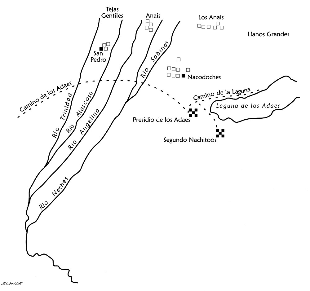
Sandoval and Franquis 1740
 Full Map |
|
This map depicts a quite distorted and enlarged view of the Los Adaes-Natchitoches area as well as all other landscape features. Jack Jackson (1998) believes that this is the map referred to in a letter that the Spanish king wrote to Castro de Figueroa, the viceroy of New Spain, dated March 23, 1741. According to the King's letter, the map represents the move of the French Captain St. Denis' fort at Natchitoches (Nachitoos) across the Red River (which is not shown on the map) closer to Los Adaes. This move caused quite the uproar among Spanish authorities who viewed this as a threatening step and encroachment upon Spanish territory. Redrawn by Sandy Hannum, from Perttula and Nelson 2006. |