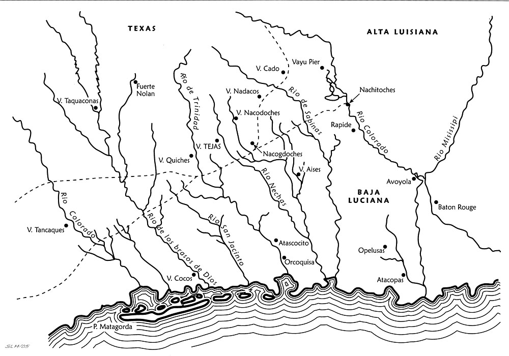
José María de Jesús Puelles 1801
 Redrawn Map |
|
Franciscan priest José María de Jesús Puelles drew maps for the Spanish officials in Louisiana during the short time period before news of the Louisiana Purchase reached New Spain. This map shows the location of Natchitoches, but Los Adaes is no longer shown, having been abandoned in 1773. Redrawn by Sandy Hannum, from Perttula and Nelson 2006. |