Guillaume Delisle 1718
 Full Map
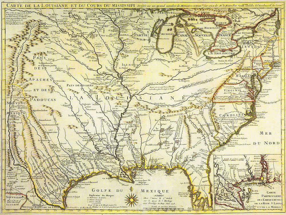
Carte de la Louisiane et du cours du Mississipi Dressee sur un grand nombre de Memoires entrau |
|
The 1718 map of the eastern two-thirds of North America by Guillaume Delisle (also spelled de L'Isle and Lisle) shows the rapid improvement of European geographic knowledge of North America as the result of eyewitness reports and of the availability of other maps done by European cartographers. Among the reports Delise drew on were those of St. Denis, the Frenchman who founded Natchitoches in 1714 and figured prominently in the history of Los Adaes. This map is perhaps the first to depict an Adais (Adaie) settlement, shown to the west of a cluster of Natchitoches villages where the French established a fort and trading post on the Red River. This map was even more influential than Delisle's 1703 map, and is said to have remained the primary cartographic reference for the Mississippi Valley until the late 1700s.
|
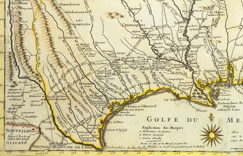 Map Detail |
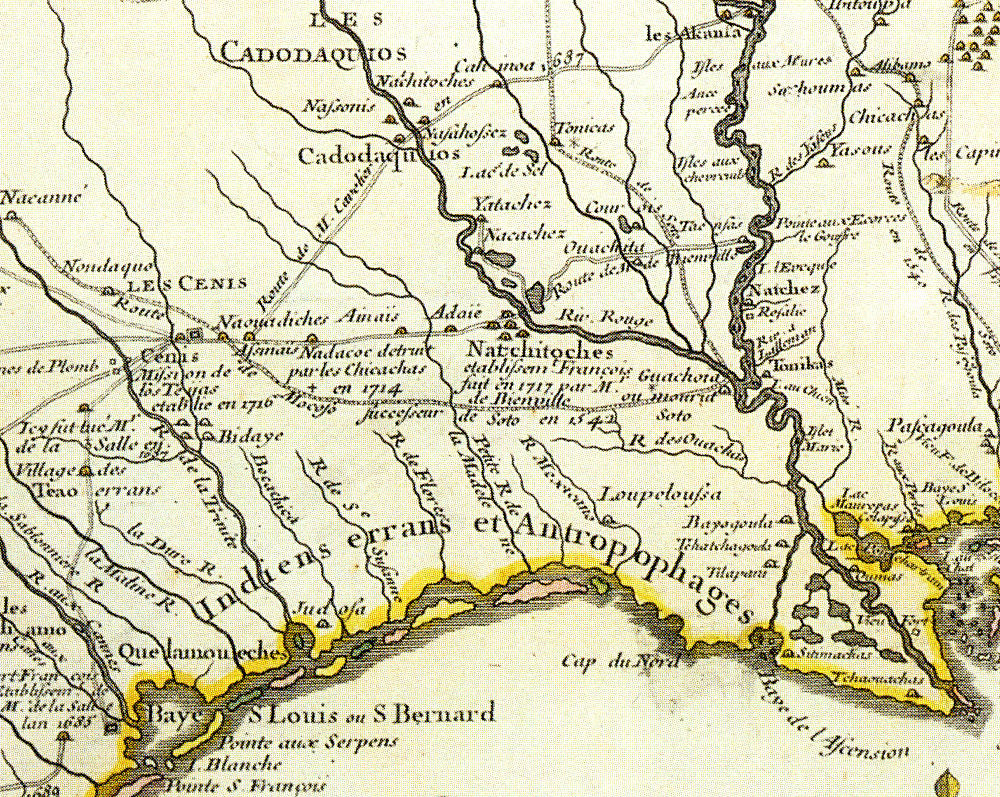 Map Detail 2X |