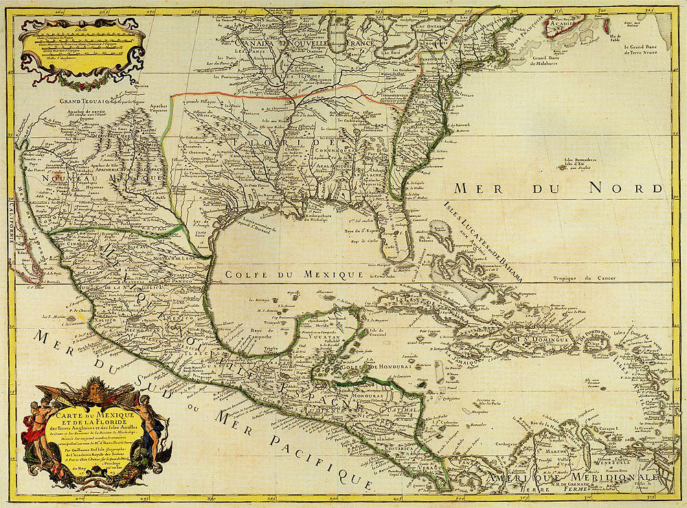
Guillaume Delisle 1703
 Full Map
Carte du Mexique et de la Floride |
|
This extraordinary map by French cartographer Guillaume Delisle (also spelled de L'Isle and Lisle) was based on reports by the French explorer Iberville as well as on a captured Spanish 1696 map of the Gulf of Mexico by Juan Bisente. It is the first reasonably accurate depiction of the lower Mississippi River and its major tributaries including the Red River. This map profoundly influenced (and was widely copied by) later European maps. The locations of various Cadohadacho and Cenis (Hasinai or Tejas) peoples are shown, as is that of the Natchitoches, but not the Adais.
|
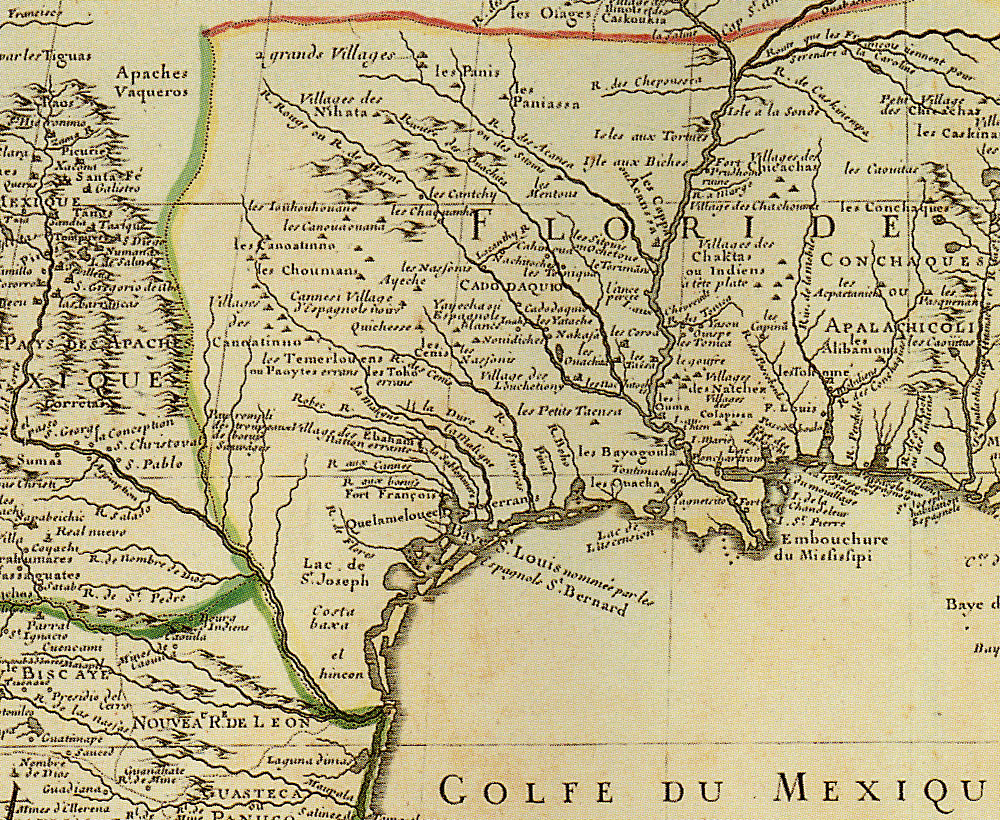 Map Detail |
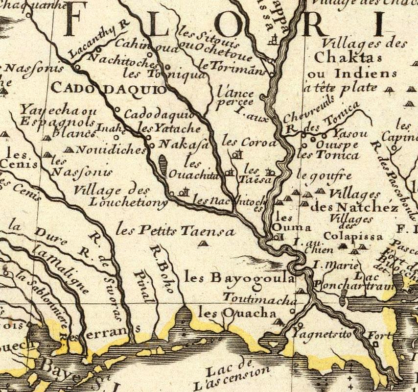 Map Detail 2X |