
Kiamichi Valley in the western Ouachita Mountains
of southeast Oklahoma. This narrow river valley appears to have been a natural
transportation route between Spiro and the Red River. Photograph by Dee
Ann Story.
Numerous streams and small rivers draining the southern and southwestern flanks of the Ouachitas flow southward and join the Red River including the Little and Kiamichi rivers. Unlike almost all other drainages in the Caddo Homeland, the Kiamichi flows west before turning south to join the Red River. The narrow valley of the Kiamichi River is thought to have been part of natural transportation route between the Red River Caddo and Spiro. From Spiro, it is relatively easy to travel up the small Poteau River, portage a few miles, and then go down the Kiamichi River, winding through the Ouachita Mountains and to the Red River.
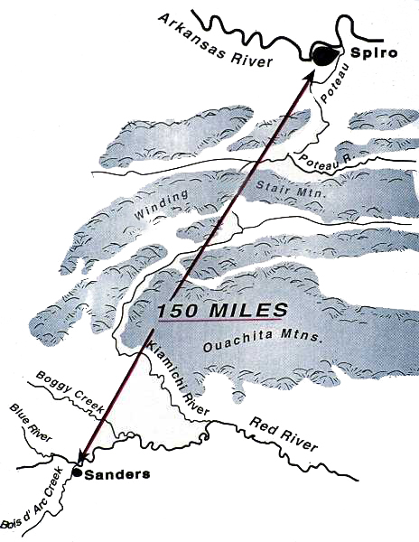
Geographic relationship between Spiro on the Arkansas
and the Sanders site on the Red River. This map shows that the Kiamichi
River was well positioned to have served as a natural transportation route
between the two sites and the two areas. Map courtesy Frank Schambach,
Arkansas Archeological Survey.