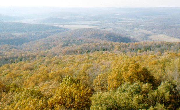
Arkansas River Valley, Franklin County, Arkansas. Photo by George Sabo, III.
The Arkansas River originates far to the west in the Colorado Rockies and flows east to southeast across the northern part of the Caddo Homeland. Its valley in eastern Oklahoma and western Arkansas is sandwiched between the Ozark Plateau to the north and the Ouachita Mountains to the south. The relatively narrow Arkansas Valley (11-15 miles wide or 18-24 kilometers) has extensive areas of rolling bottomlands with fairly deep fertile soils. The valley also contains Ozark and Ouachita Mountain outliers, some of which reach the highest elevations in the region. In prehistoric times the vegetation was a mosaic of hardwood forests, savannas and tall-grass prairies. Compared to the adjacent upland areas, the low-lying valley was (and is) much better suited for farming.