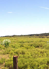
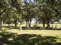
Prairie north of the Brazos River
through which the U.S. Troops escorted the Caddo, Anadarko,
Hainai, and a few Wichita and Delaware in 1859 on their
way to Indian Territory. The troops protected the Indians
from vigilante settlers. Photo by Susan Dial.
|
|
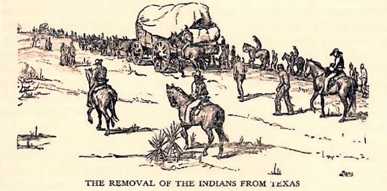
For twenty years following the 1835 Treaty ceding
Caddo lands in Louisiana to the United States, the people
of the ancient Caddo Nation were without a safe place to call
home. In 1855, the State of Texas permitted the United States
government to open an Indian reservation on the Brazos River
in present Young County. The Caddo, Anadarko, and Hainai in
Texas, along with fragments of Wichita and Delaware tribes,
moved there, believing they would have a safe, permanent home.
That prospect was shattered late in 1859. Caddos had good
friends among established frontier settlers who knew them
well, but another group of Texans had an avowed intent to
destroy the Brazos Reserve and exterminate all Indians. State
authorities failed to give support against their violent activities.
Major Robert Neighbors, Special Agent for Texas Indians, acknowledged
the impossibility of protecting the Reserve Indians without
armed conflict between U.S. troops and a mob of three to four
hundred lawless men. He urged the U. S. Commissioner of Indian
Affairs to authorize a removal to the safety of Indian Territory.
The Commissioner approved the exodus from Texas but thought
it was first necessary to build a military post in the district
to be occupied. Before that could be accomplished, the situation
on the Brazos reached crisis and the order was issued for
immediate removal.
|
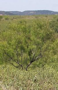
The mesquite-covered prairie in Young County, Texas near where
the Brazos Reserve existed for a few short years. Photo by Susan
Dial.
Click images to enlarge
|
|
| |
Grandpa and grandma said they made
a treaty other there and my [husband's] father's
brother was interpreter. . . they just said they had to move
out of Louisiana to come to Oklahoma somewhere and when they
brought them instead of bringing them here they brought them
to Texas. . . and from there they had to move from Texas because
the people were mean to them.
Sippie Edmonds 1968
I heard my mother, many times. They
talked about the hard times they used to have. . . she said
all this was told by her mother. . . I heard them talking
that they moved to the Brazos River. . . I heard them talk
about when they were in Texas that they, the government, wanted
them to move and they had the soldiers to move them out of
Texas. . . they were driven out of Texas . . . To Oklahoma
. . . that the soldiers was very kind to them and they were
the ones that moved them . . . a lot of them had to walk and
some horseback and they really had a hard time.
Caroline Bird 1968
|
|
|
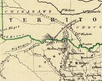
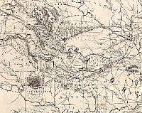
Lange map of 1854 showing Texas and
the Indian Territory (published in Germany). Courtesy
David Rumsey Map Collection.
|
1869 map by Henry Jackson showing
the Indian Territory. Courtesy David Rumsey Map Collection.
|
|
Indian Territory 1859-1867
Caddos, Anadarkos, and Hainais camping on the
south bank of the Washita River near present day Anadarko,
Oklahoma on August 17, 1859, were resting from an arduous
journey. They had traveled 170 miles since leaving their reservation
homes in Texas on the first day of August. There had been
one birth and one death along the way. The escort of federal
troops that protected them from attack by Texans below Red
River and bands of angry Comanche and Kiowa Indians roaming
north of the River had been recalled to their Texas post.
Major Neighbors issued the last of the rations supplied for
their flight. He would leave as soon as their new agent arrived.
The trail from the Texas Brazos Reserve brought
the Caddo, Anadarko, and Hainai families to a part of Indian
Territory known as the Leased District. The area acquired
the designation in 1855 when the Choctaw-Chickasaw Nations
leased that part of their assigned lands to the United States
for the purpose of providing a home for the Wichita and "such
other tribes of Indians as the Government may desire to locate
therein". S. A. Blain, previously appointed U. S. Agent
for the Wichita, unexpectedly had the Caddos, Anadarkos, and
Hainai added to his Wichita Agency. Historical confusion would
have been avoided if it had been properly designated as the
Wichita-Caddo Agency.
Major Neighbors turned his census over to Blain—462
Caddos, Anadakos, and Hainais. Not counted were those who
fled the Brazos Agency after attacks by Texans in 1857. Neighbors
also gave Blain an inventory of property left behind on the
Brazos Reserve. The inventory included 76 grass and log houses
valued at $3545. The self-proclaimed protectors of Texas ranging
the perimeter of the Reserve had made it too dangerous for
Caddos to gather all their livestock. He fully expected that
Indian owners would be reimbursed for their forfeited property
and stock.
|
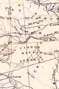
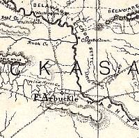
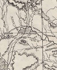
Kemble map of 1857 showing north
Texas and the southern Indian Territory. The"Caddos,
Wacos, and Andakas" are shown in north Texas well
north of the Brazos Reservation but south of the Red
River. Courtesy David Rumsey Map Collection.
|
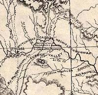
Detail of 1869 Henry Jackson map
showing area where Caddo and Wichita peoples moved in
1859. Courtesy David Rumsey Map Collection.
|
|
|
| |
. . .when they moved them out of
Texas to Oklahoma . . .they had to take only a few things
that they could carry in their wagons, and it was quite a
struggle for them to travel in those days . . . our mother
told of hearing her mother telling of moving a sow and pigs.
They carried the pigs in the wagon and the old sow walked
until her feet bled and they had to make room in the wagon
for her. . . .my mother would always speak and look forward
to the time when the government would reimburse them and she
would refer to it as a bag of money hanging on a rope, and
the rope was just about to break and of course my brother
and I would tease her and tell her that the rope was really
cable, and that cables were seldom broken. We made it a joke,
but now as I am reaching the age of 60 I wonder if truly it
might be a cable.
Maude Simmons, 1968
|
|
|
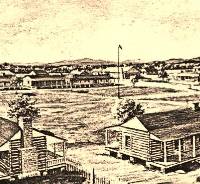
Old Fort Arbuckle in Indian Territory established
1851, closed 1870.
|
Reunion and Resettlement
A month before their final departure from Texas,
Major Neighbors brought head men from the Brazos Reserve to
Fort Arbuckle in Indian Territory for a council with the Southern
Superintendent of Indian Affairs. The Council brought together
the Caddos who moved to Texas soon after their Louisiana homeland
was ceded to the United States in 1835, and a group detained
in Louisiana until 1840. The latter group became known as
Whitebead Caddos because an elder woman named Whitebead held
the group together during a long journey across Indian Territory.
|
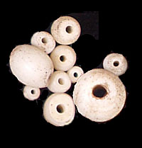
White beads, like these trade beads, were the namesake of the
elder Caddo woman who held her group together on the journey
across Indian Territory in 1840. |
|
| |
They stopped there, Kiamiche, and
just the Whitebeads, they stopped round what you call Pauls
Valley. They come across—just like you cut through the
pasture. They did not follow the road, they angled like, follow
this creek. They call it Washita today. From Red River, they
just kinda cut across and follow Washita.
Julia Edge, Whitebead
descendent, 1978
|
|
|
| |
The Whitebeads first went to old Red River Caddo
country near the mouth of the Kiamichi River. It was no longer
Caddo country when they arrived. It was Choctaw country, part
of the Indian Territory assigned to the Choctaw Nation by
treaty with the United States in 1830. The arrival of the
Caddos was tolerated but resented by Choctaws. Traveling on
west, the Whitebeads came to Fort Washita, stayed a while,
then went on up the Washita River to settle on Wildhorse Creek.
They were living eighteen miles below Fort Arbuckle when Neighbors
escorted headmen from Texas to the council held there. The
present Oklahoma town of Whitebead west of Pauls Valley is
the approximate site their former community.
The council at Fort Arbuckle convened June 30,
1859. Superintendent Elias Rector had just returned from an
exploration to locate sites for the new agency, a military
post, and tracts of land suitable for settlement by the Caddos
being moved from Texas, the Whitebead Caddos, and the Wichitas.
Fear of Comanche attack had caused the Wichitas to take refuge
near Fort Arbuckle in October 1858.
Rector and Neighbors "fully conferred"
before opening the council. Then, speaking to the gathered
chiefs and headmen, they expressed regret for the hasty removal
from Texas, assured payment for all losses incurred, and pledged
that after removal they and their children would live in a
country "as long as the waters should run, protected
from all harm by the United States.
|
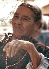
Julia Edge, Whitebead descendent;
Whitebead Caddos were among the last to leave the ancient
territory of the Caddo Nation. Photo by Cecile Carter.
|
The Whitebead Caddos followed the
Washita River and formed a community near Fort Arbuckle.
If you look closely, the Whitebead community is depicted
on this 1869 map by Henry Jackson (just south of Washita
River). Courtesy David Rumsey Map Collection.
|
|
|
| |
the great pain and regret felt by the government at being
compelled so hastily to remove those in Texas to another country;
but assured them that they would be paid for all losses thus
incurred; and that, after removal, they would occupy a country
belonging to the United States, and not within any State, where
none could intrude upon them; and they would remain, they and
their children, as long as the waters should run, protected
from all harm by the United States. |
|
|
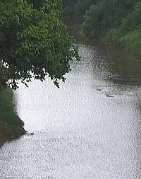
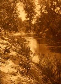
The Washita River near Anadarko, Oklahoma where the Caddo
settled in 1859. Photo by Cecile Carter. |
Cemetery at Fort Belknap where Major
Neighbors is buried. Photo by Susan Dial
|
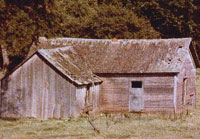
A late 1800s Caddo wood-plank house
still standing in 1978. Photo by Cecile Carter, whose
Great Grandmother, Fannie Brown, lived in the house.
|
|
Rector recommended a site on the south side
of the Washita River for the Agency. The "Texas Indians"
(Caddo, Anadarko, Hainai, and Delaware intermarried with them)
could locate their homes above and below the agency or, if
they wished-along Sugar Creek on the north side of the Washita
where the Whitebead Caddos and Delawares living among them
indicated they wanted to settle. The chiefs and headmen were
already familiar with the country described, they trusted
the words spoken by Neighbors and Rector and so accepted the
Fort Arbuckle Agreement concluded July 1, 1859. Though descriptions
of the proceedings and specific details of the agreement were
recorded in government reports, no formal document was written
and signed. It was many years before a permanent boundary
of the land assigned to the Wichita, the Caddo, and their
affiliated tribes was officially defined.
Major Neighbors, who never failed to back Caddo
efforts to lead peaceful, settled lives on the Brazos Reserve,
transferred their care to Agent Samuel Blain and left for
Texas on September 6. Eight days later he walked into the
town of Belknap where he was fatally shot by a white man who
hated him for being a friend of the Indians.
The first Agency building was located near the
present town of Fort Cobb. The military post, Fort Cobb, was
established October 1, 1859, one mile east of the present
town with that name. Assured of protection from marauding
Kiowas and Comanches, the Caddos, Anadarko, and Hainai selected
home sites and set to work building shelter for the winter.
Neither the weather nor events forecast prosperous
settlement during the first year. The thermometer reading
at Fort Cobb fell to 5 degrees below freezing in February
and rose to 115 degrees in August. No crop could be raised
for the first winter. Deer, turkey, and a great number of
buffalo ranged the area but hunting was hampered by a shortage
of horses and weapons. Starvation was staved off by government
rations. Raiding Kiowas and Comanches and recurring reports
of threats and invasion by Texas frontiersmen kept the Agency
tribes in an anxious state.
Despite such difficulties, Caddos managed to
build 23 "picket houses" covered in grass, 18 log
or plank houses. Anadarko constructed 33 "picket houses"
covered in grass, five board houses. Iesh (Jose Maria) of
the Anadarkos, Tinah of the Caddos, and Showetat (Caddo George
Washington) of the Whitebead Caddos each had log houses built
for them.
|
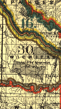
Vicinity of Fort Cobb, where the
first Wichita Agency building was located and near which
many Caddo settled. The military post, Fort Cobb, was
established October 1, 1859, one mile east of the present
town with that name. 1869 map by Henry Jackson. Courtesy
David Rumsey Map Collection.
|
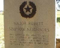
Marker at grave of Major S. Robert
Neighbors, a man whose fairness as an Indian Agent cost
him his life. Photo by Susan Dial
|
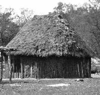
This picket-wall house in Chief Long
Hat's camp is probably very similar to the 33 "picket
houses covered in grass" that the Andadarko built
soon after moving to Indian Territory. 1872 photograph
by William Soule, courtesy Smithsonian Institution.
|
|
|
| |
There are three different kinds of
houses that were used by the Caddos. The log cabin, the grass
house, and the Bark house. All of the Caddo houses were oblong,
and all faced the east. The log cabins were very much like
a white person's with doors on any side, but always one in
the east and west. The grass house differs from the Wichita's'
by having a door in both the east and west, while theirs have
only the one in the east and their houses were round. The
Caddos also had openings rather high up on the north and south
for air. The bark house was not really made of bark but it
was roofed with bark. The walls were made of split logs stood
on end and plastered with clay and cattail reeds. These reeds
were ground to a pulp and mixed with the clay. On the top
of the house there was a frame made of slippery elm and on
this the bark was fastened. The bark had to be well seasoned.
It had to be kept flat while seasoning so it wouldn't warp.
It usually took several months for the bark to season. These
houses had doors only in the east and west. The doors to the
houses were made of cedar if it could be gotten, if not they
used dogwood.
Mrs. Frank Cussins, daughter
of Tall Woman who was the last surviving Caddo Indian woman
who came over the Trail of Tears
|
|
|
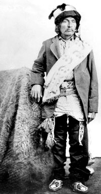
George Washington, Whitebead Caddo leader,
was at the head of the Caddo Frontier Brigade during the Civil
War. 1870s photograph taken at Fort Still by William Soule.
Courtesy Oklahoma Historical Society.
|
By September 1860 they had cultivated seventy-three
and a half acres.
The Civil War Years 1861-1867
Peace, however, was not to be cultivated. The
Civil War intervened. Union troops at Forts Washita, Arbuckle
and Cobb were ordered to Fort Leavenworth, Kansas on April
17, 1861.Confederate troops from Texas established headquarters
at the Agency near Fort Cobb. Still fresh memories of maltreatment
by Texas troops compelled most Caddos, Anadarkos, and Hainais
to seek refuge in Union controlled Kansas. Some sought safety
as far away as Colorado. Smaller numbers went to live with
the Seminoles in Indian Territory or to Whitebead Hill among
the Chickasaws. A few could not let go of the place where
it was promised, "they would remain, they and their
children, as long as the waters should run". They
signed a Confederate agreement that promised protection, food
and supplies, and continued residence on their assigned lands
in Indian Territory.
Caddo George Washington, leader of the Whitebead
Caddos, Caddo George Washington served as Captain of the Indian
spies the Confederates mustered to protect the Agency. Near
the end of the War, when Confederate military authorities
organized a Reserve Squadron of Cavalry to protect frontier
Chickasaw settlements from marauding Comanches, he held the
rank of major in command of two-companies designated as the
Caddo Frontier Guard. The venerable Anadarko Chief Jose Maria,
who honorably struggled to maintain peace during the turbulent
years in Texas, is described as a sub-chief and Captain of
the Caddo Frontier Guard. Caddos say he died before the Civil
war. No matter who, Caddos soon recognized that the Confederate
government could not or would not meet its obligations.
Five years of hunger, severe weather exposure,
and disease took their toll before those who followed the
federal troops into Kansas were escorted back to their Indian
Territory home in 1867. They returned to find houses ruined,
fields destroyed, and great portions of their land assigned
to other, less peaceful, tribes. Though destitute and physically
weakened, they set to work rebuilding the Caddo Nation.
|
The Federal Government gave large sections
of land first assigned to the Wichita-Caddo and affiliated
tribes in the 1859 Arbuckle Agreement to warring Kiowa, Comanche,
Cheyenne and Arapaho tribes who signed peace treaties.
|
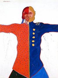
"Soldiers," a painting by T.C.
Cannon, son of a Kiowa father and a Caddo mother. Courtesy
of the Tee Cee Cannon Estate and Joyce Cannon Yi, estate executor.
|
Edward Curtis photo of Washita River. |
|