Thirty years later, we headed down the ravine
toward the same cave, Bonfire Shelter.
Click images to enlarge
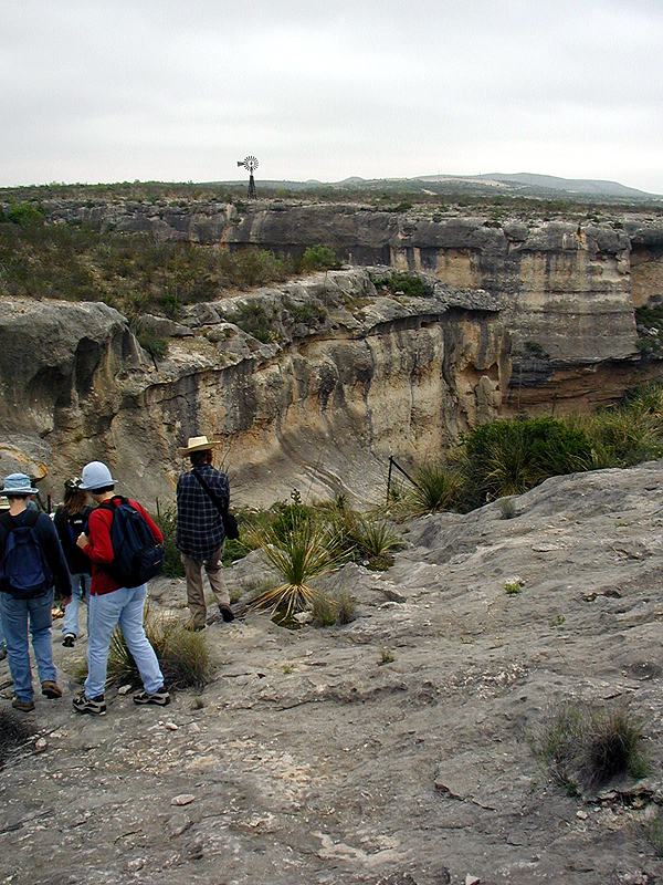
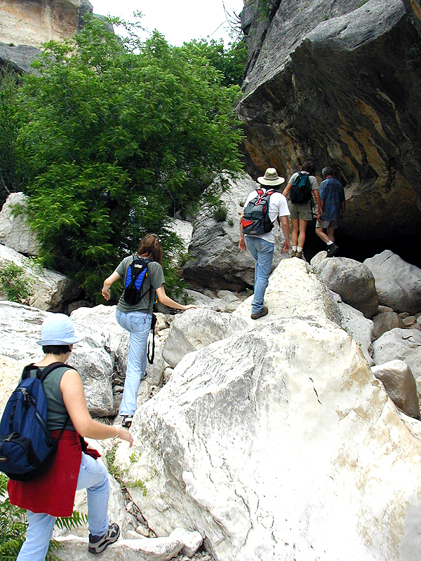
We enter Mile Canyon through a steep ravine
following goat trails.
Reaching the Mile Canyon proper, we head downstream
along an almost imperceptible rock ledge favored by sure-footed
goats.
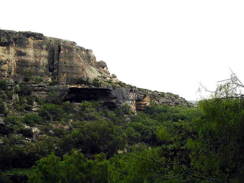
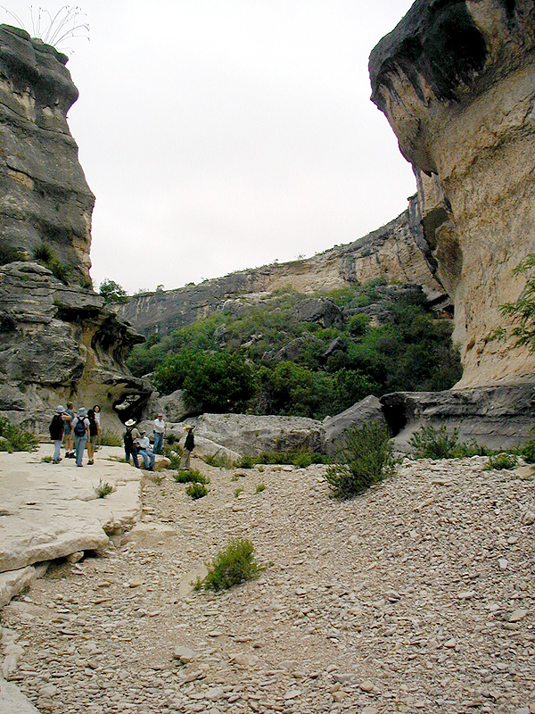
Our first destination is Kelley Cave, a modest-sized
rockshelter visible in this photo as a dark hole. An adjacent rockshelter, Skiles Shelter, lies just below and to the right of Kelley Cave.
Kelley Cave was first tested by archaeologists E. B. Sayles and J. Charles Kelley in 1932. Uncontrolled digging in the late 1930s did considerable damage. The surviving deposits contain many
fragments of plant fibers, animal bones, charcoal, stone-tool-making
debris, and spent cooking rocks. These traces show that the
rockshelter was lived in countless times over thousands of
years.
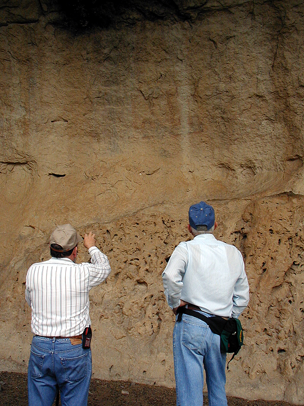
Elton Prewitt and Jack Skiles look at faded
pictographs—painted images—on the protected rear wall
of nearby Skiles Shelter.
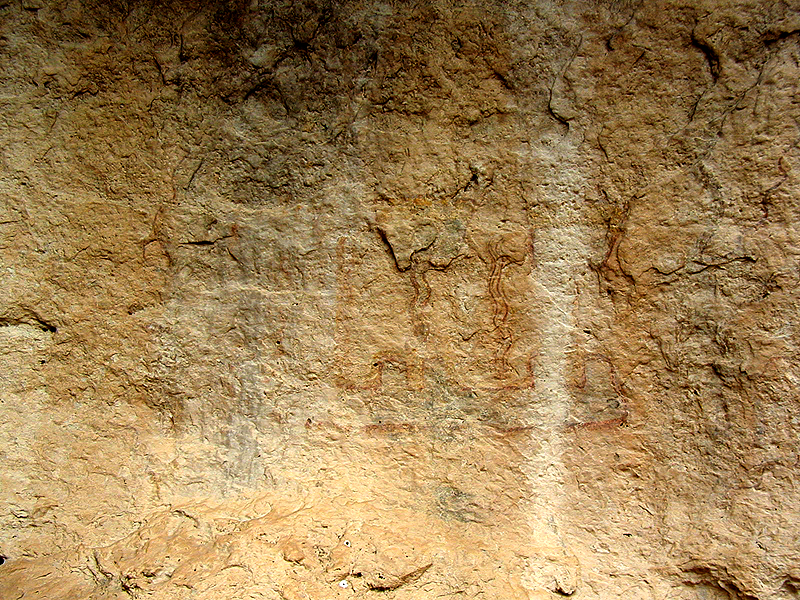
Close up of pictographs at Skiles Shelter. These
paintings were created over 3,500 years ago. Most are thought
to be symbolic expressions of the sacred rituals and beliefs
of Lower Pecos peoples.
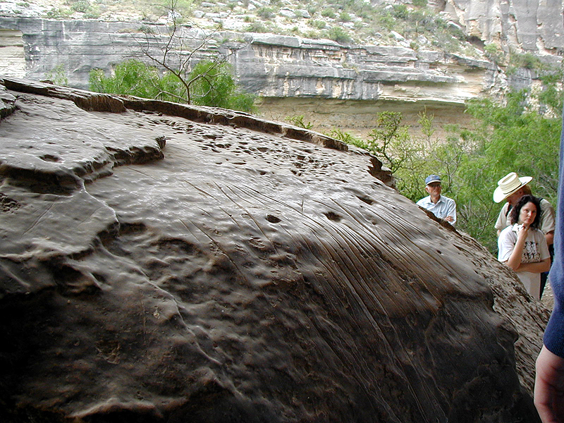
The upper surface of this limestone boulder
in Skiles Shelter is worn slick from being rubbed by countless
people, possibly during leather or fiber working. The sharp grooves
may have resulted from dulling the edge of chipped-stone tools
during tool making.
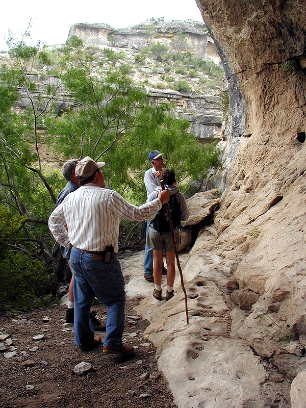
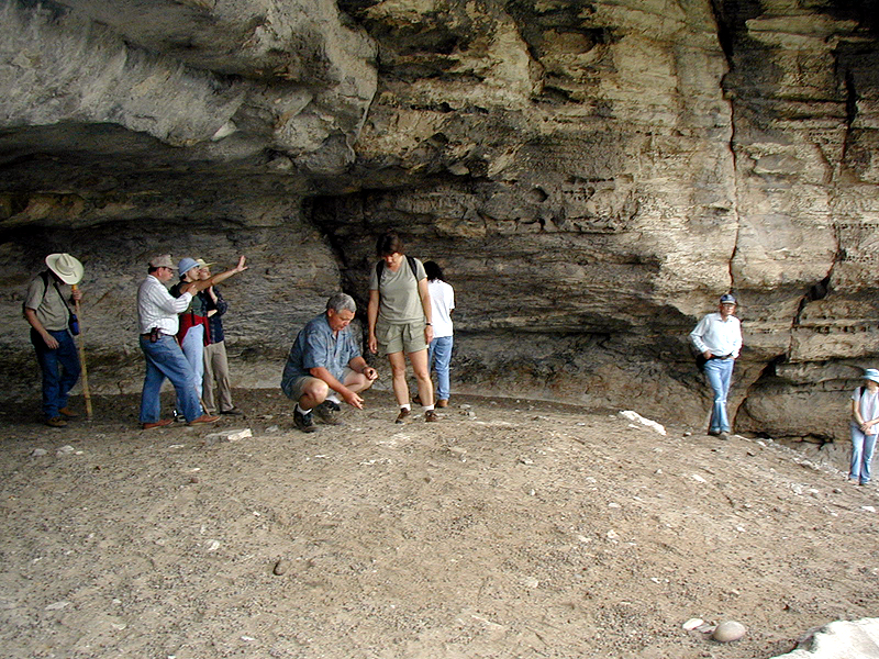
During the late 1950s and early 1960s, archeologists
from The University of Texas visited Skiles Shelter and hundreds
of other sites in the area prior to the damming of Amistad
Reservoir. Here the group looks for the small dark green "V
V numbers" —Val Verde County site numbers—which
archeologists painted in each cave and rockshelter they recorded.
During the survey work, small teams of archeologists spent
many months combing the canyons for sites and they sometimes
lost track of which shelters they had visited. The V V numbers
helped avoid confusion.
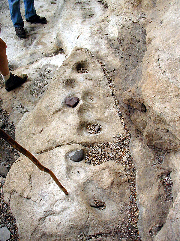
These shallow bowl-shaped depressions in the
bedrock along one wall at Skiles Shelter were used along with
hand-held grinding stones (called manos) to pulverize seeds
and nuts.
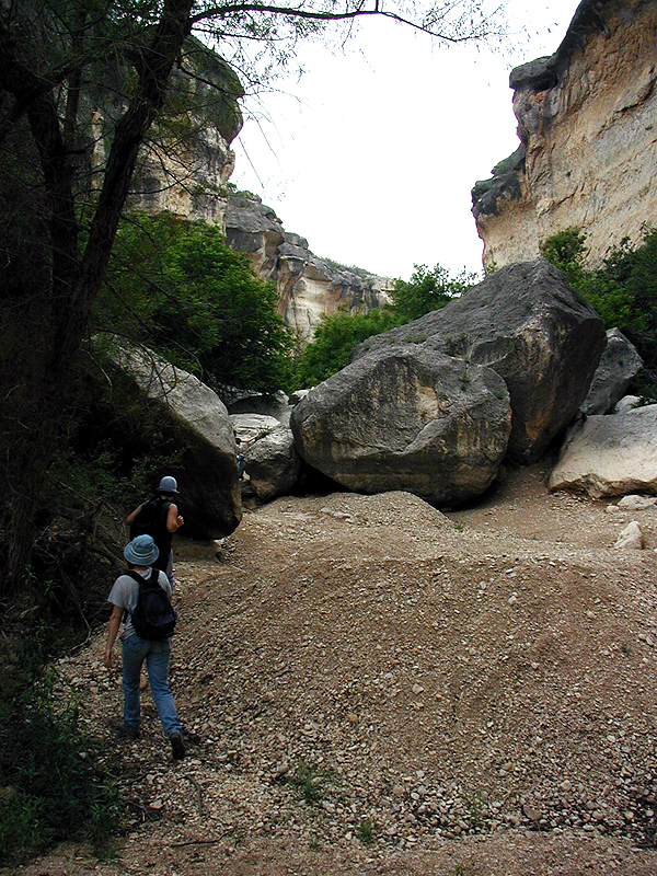
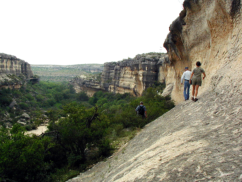
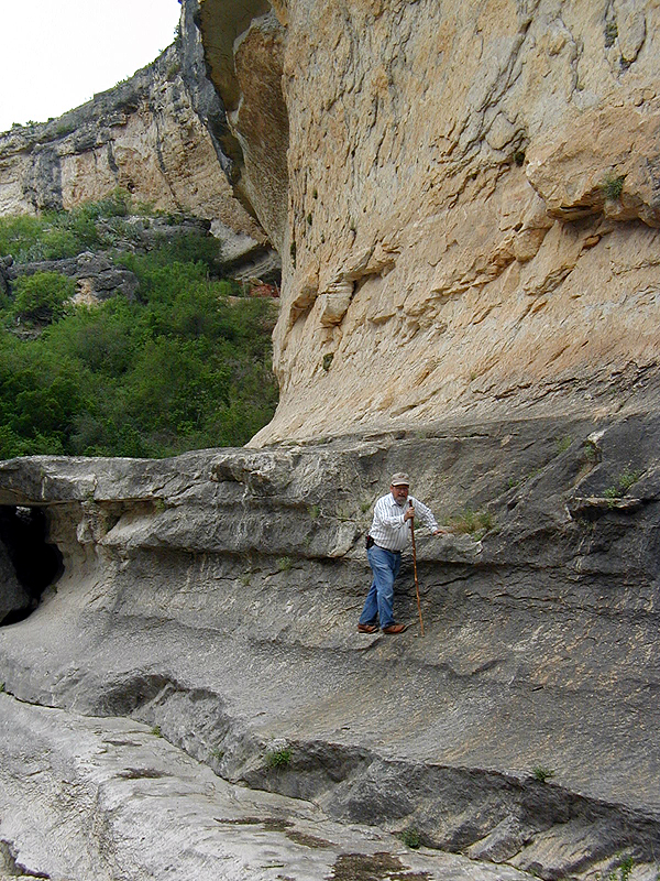
Leaving Skiles Shelter, we head upstream past where
we entered Mile Canyon. The large boulders you see here may
look like permanent fixtures, but once or twice a century
raging floodwaters move even house-sized boulders. Each catastrophic
flood changes the topography of the canyon, spring-fed pools
become choked with gravels, new springs emerge, and walnut
trees are ripped out. Such events would have impacted the
lives of the Lower Pecos hunter-gatherers and caused shifts
in settlement patterns that may have lasted for several generations.
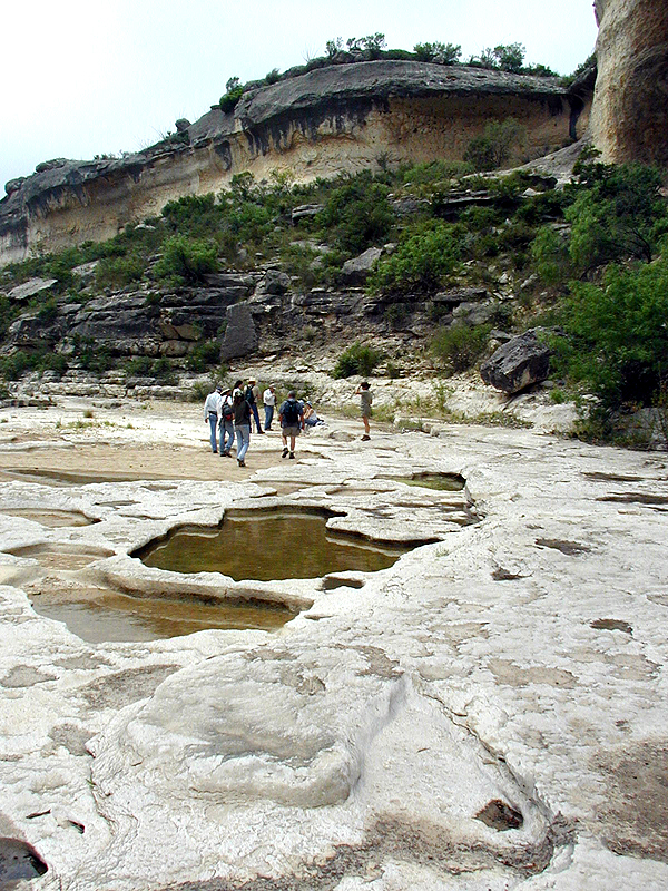
The winter and early spring of 2001 were unusually
wet in the Lower Pecos. Weeks after the last rain, water still
stands in numerous small pools. By the middle of summer, water
will be scarce and only available at a few large pools and
permanent springs.
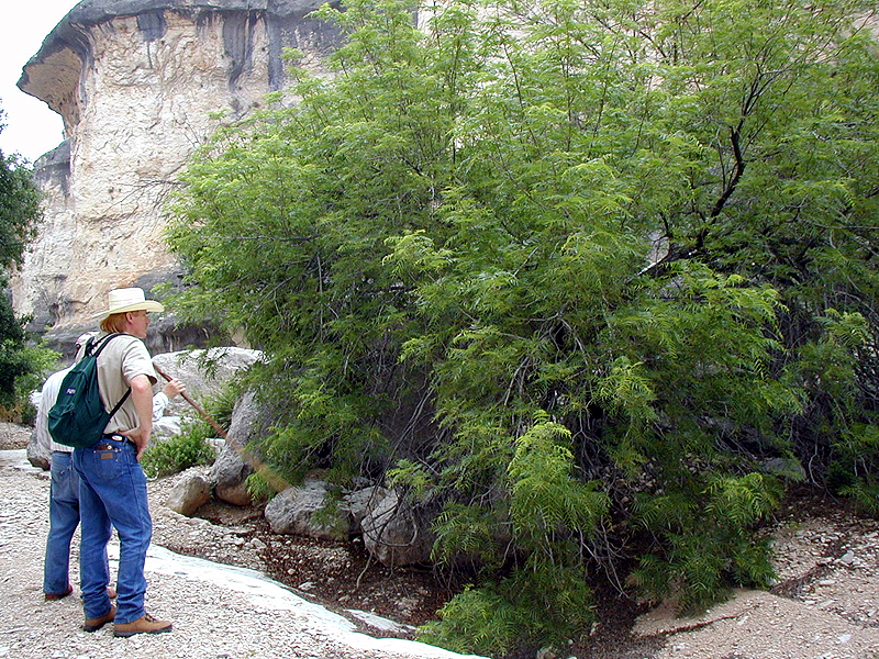
Because of the ample winter rains, this Texas
Black Walnut tree will bear a large crop of tasty and nutritious
little nuts. Walnuts are one of many resources that are only
available in certain times of the year and in certain places
in the landscape. In the Lower Pecos region, walnuts only
grow in the protected canyons where their roots can find water.
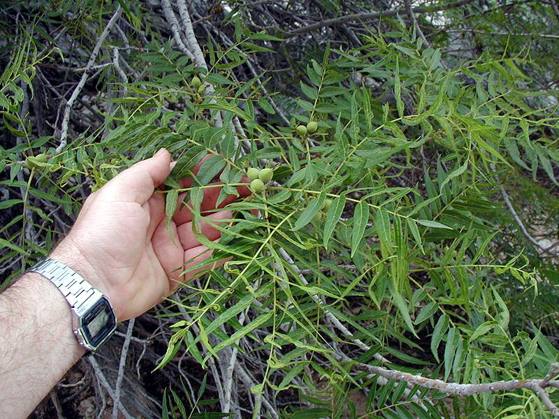
Close up of green walnuts. These will grow and
slowly ripen over the spring and summer, becoming edible in
early fall. Good things may come in small packages, but wild
walnuts are tough nuts to crack and require special pulverizing
techniques such as the use of the shallow bedrock depressions
in the caves.
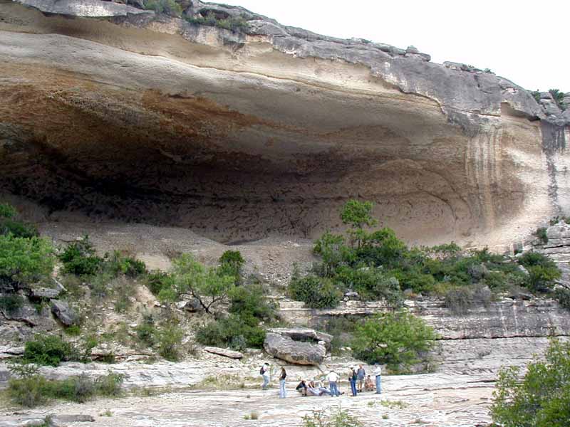
Midway up the canyon we come to Eagle Cave,
the biggest rockshelter in the canyon and one of the largest
in the region. This natural erosional feature was sculpted
by water and wind over an immense stretch of time. When prehistoric
peoples first entered the area, at least 13,500 years ago,
they began using natural shelters like Eagle Cave.
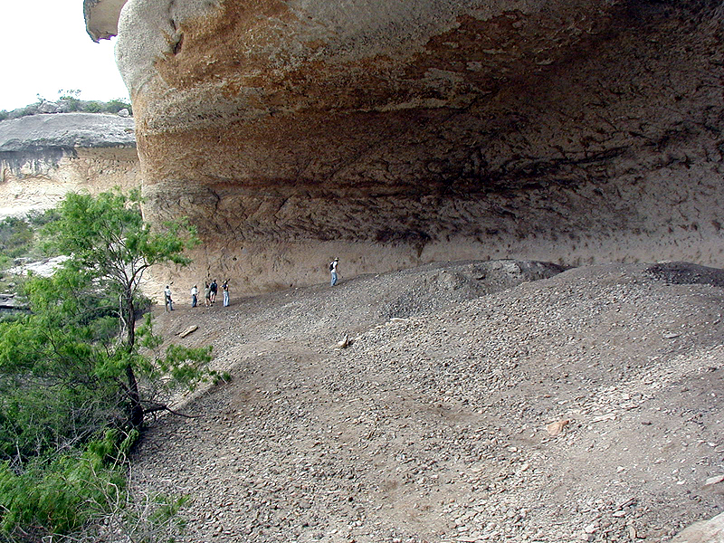
Eagle Cave is filled with massive trash deposits
representing countless everyday activities in the lives of
prehistoric hunter-gatherers. Called "midden" deposits
by archeologists, these gray ashy layers are filled with spent
cooking rocks, animal bone, plant remains, broken stone tools
and all sorts of other artifacts and natural objects hauled
into the shelter by its inhabitants.
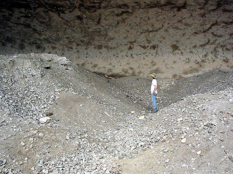
Archeologist Rob Thrift stands in the bottom
of the main excavation trench dug by explorers from the Witte
Museum in 1936 and reopened and excavated deeper in 1963 by
Univerisity of Texas reseachers. The trench has slumped in,
but it still gives you a good idea of how thick the deposits
are. The lowest cultural layers in Eagle Cave have never been
reached.
This photo shows what is left of the upper layers
of the cave as exposed in the old trench walls. The dark brown
layers are perfectly preserved plant fibers: grass, leaves,
stalks, and all sorts of plant debris cast aside more than
a thousand years ago. The dry climate and protected shelters
preserve things that are never found at open campsites.
The walls of Eagle Cave were once covered with
hundreds of pictographs, most of which were created over 3,500
years ago. Most of these have faded with time or are obscured
by the dust kicked up during the 1936 and 1963 excavations.
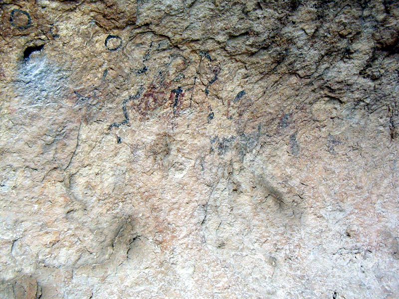
Close up of some of the pictographs in Eagle
Cave that are still visible. Today these pictographs are known
mainly from the fine copies made by Forest Kirkland in the
1920s and 1930s.
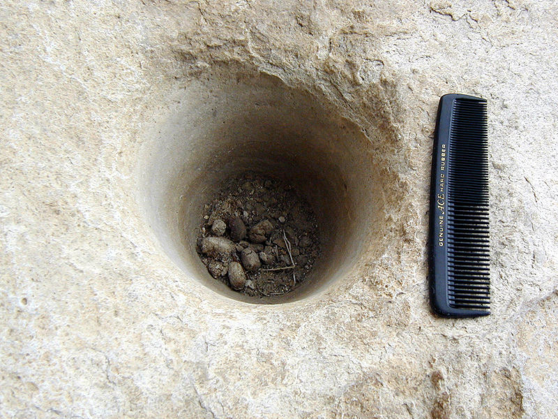
A wooden pestle may have been used to pound
mesquite beans or similar resources into flour in this bedrock
mortar hole at Eagle Cave.
View up Mile Canyon from Eagle Cave. Bonfire
Shelter lies just around the bend.
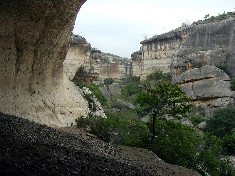
Upstream from Eagle Cave, Mile Canyon continues
to narrow and in places we must squeeze through narrow rocky
passages.
The group stops to rest below Bonfire Shelter.
The shelter is just visible to the right half way up the canyon
wall.
Elton Prewitt on the precarious "trail"
used by 1963-64 excavation crew to approach and exit Bonfire
Shelter. The shelter is visible in the background. Just below
Elton is a small pool of water that came to be known as "Bic
Pen Springs" because of all the yellow ballpoint pens
that fell out of Dave Dibble's pocket as he crawled up this
steep slope and collected there during the field season.
Elton Prewitt stands below the south end of
Bonfire Shelter and recounts the excavation of Bone Bed 3.
Behind him is the talus cone below the notch in the cliff
through which hundreds of bison fell.
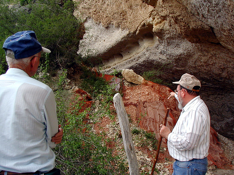
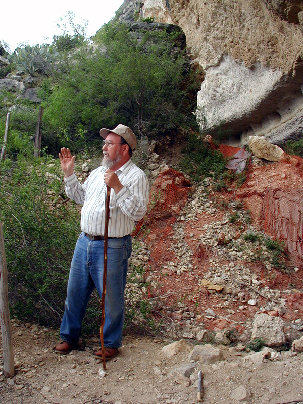
Elton Prewitt points out areas where more protective
material is needed to Jack Skiles. In 1990, Elton and a crew
of volunteers wrapped the talus cone in burlap bags topped
with orange plastic mesh to help retard erosion. Runoff from
the occasional heavy rain drains into the cave and erodes
Bone Bed 3.
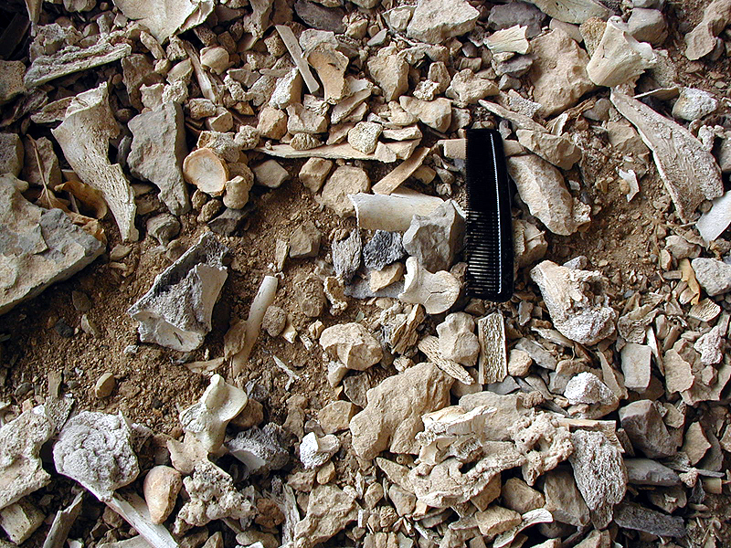
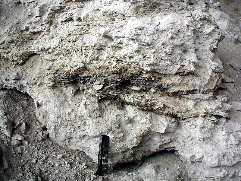
Close up view of the burned bison bone fragments
that continue to erode from Bone Bed 3, the Late Archaic jump
episode(s) that occurred about 800 B.C.
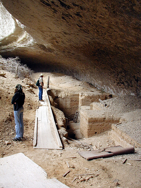
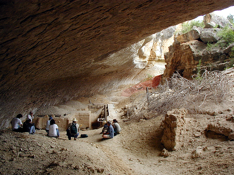
View from the talus cone at the south end of
the shelter to the central area where the main excavations
were carried out. The wooden walkway helps protect the still-open
excavation holes from caving in.
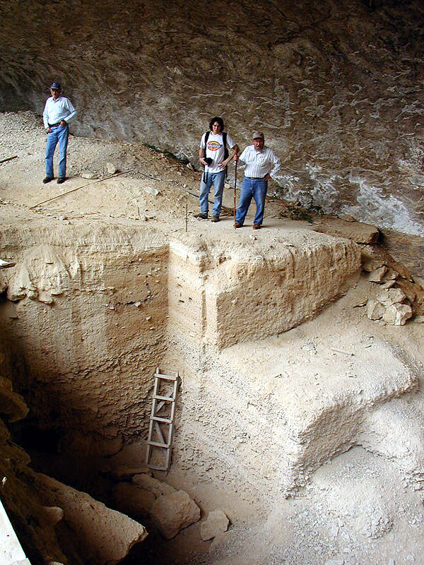
View of the excavation walls near the rear of
the shelter. Notice the stratified deposits of cave dust and
roof spall. Bone Bed 2 lies just above the wooden ladder.
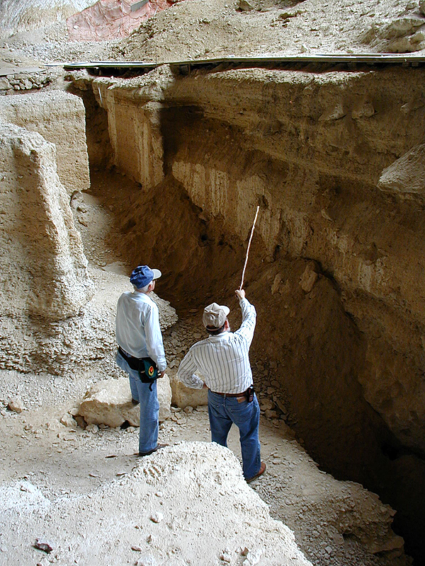
Elton points out to Jack places where the main
excavation walls have recently slumped. The two are planning
on shoring up the walls to protect the remaining deposits.
But first, Jack wants archeologists to find the bottom of
Bonfire Shelter.
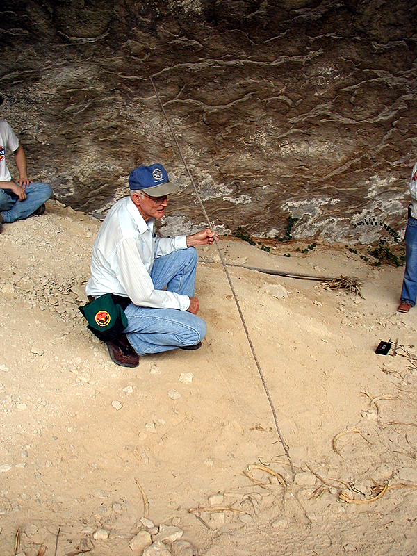
Jack Skiles holds the welded rebar he used to
probe below the deepest excavations at Bonfire Shelter. Jack's
probe revealed that there are at least 10 feet of gravel deposits
at the bottom of the shelter below the deepest known bone
layers.
View of central area of Bonfire Shelter from
the north. The massive rock pile (fallen roof blocks) upon
which most the bison fell is visible on the right.
|