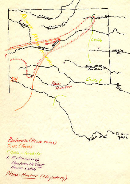
Map drawn by Sayles of the Texas Panhandle showing the approximate distributions of distinct cultures as he saw them. The hatched red line demarks the area containing slab-house ruins. This map was probably drawn in 1932. TARL archives.
Close Window