|
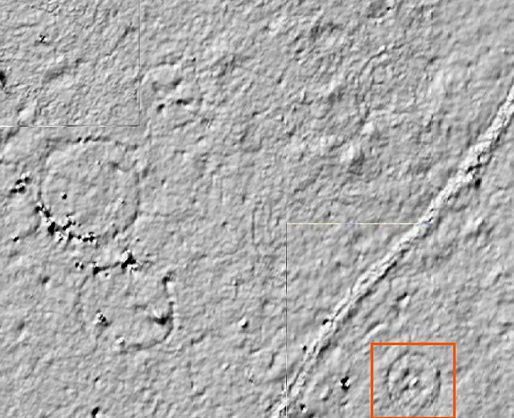
| Section of geophysical map showing a small area at the George C. Davis site in which at least three structural patterns are readily discernable. The orange square highlights a circular pattern of a building about 11 meters (36 feet) across with four internal roof supports and a hearth in the middle. The angled line running through the image is one of the signature of one of the interpretive footpaths at Caddoan Mounds State Historic Park. (The right-angled glitches are minor data/processing gaps.) Courtesy Darrel Creel and Dale Hudler, TARL. |