|
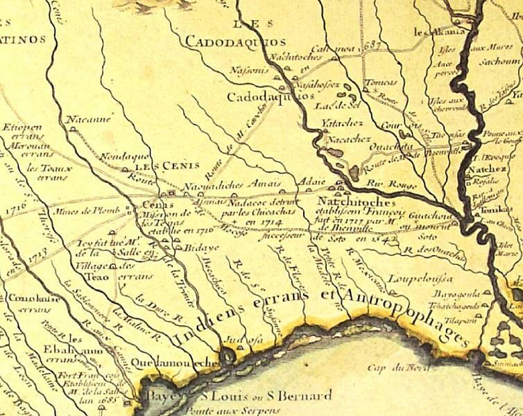
| Map showing Native America as perceived by the French in the early 18th century. This was one of first reasonably accurate depictions of the Mississippi and its tributaries including the Red (Rogue). The locations of Cadohadacho (Cadodaquios), Hasinai (Les Cenis), and Natchitoches are shown. From Carte de la Louisiana et du Cours du Mississipi, by Guillaume Delisle, 1718. |