|
|
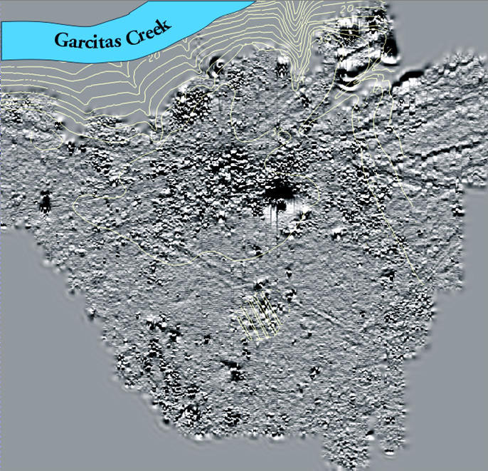
| Magnetometer map overlying a topographic relief map of the site. The yellow lines denote changes in elevation in the natural terrain. The roughly circular ring consists of dipole anomalies representing fluctuations in the soil's magnetic field caused by disturbances, such as digging or burning, or by concentrations of metal objects. This magnetic ring corrleates to the circular alignment of Spanish presidio structures. The dark depression in the center is a modern feature. Graphic courtesy of THC. |