Anthon Site
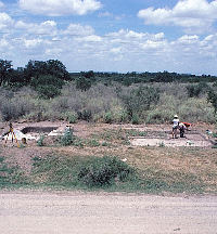
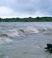
The Anthon Site (41UV60) is a campsite on a terrace of the Nueces River in southern Uvalde County, about 25 miles below the Balcones Escarpment. Although this puts the site in the northwestern part of the South Texas Plains, it is within a broad ecotone or ecological transition zone between the Edwards Plateau to the north and the core of the South Texas Plains to the south.
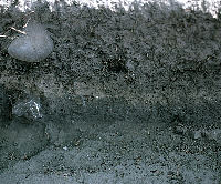
Excavations at the Anthon site documented numerous chipped and ground stone artifacts dating to the Late Archaic and Late Prehistoric periods including dart points, arrow points, bifacial knives, flake tools and manos. Though organic material (such as animal bone) was not preserved, the large chipped stone assemblage at the site allowed archeologists to gain insight into the behavior of groups who moved between the South Texas Plains and the Edwards Plateau during the Late Archaic period, about 3,000 years ago (1,000 B.C.).
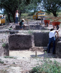
Archeologists from the State Department of Highways and Public Transportation (now TXDOT) discovered the Anthon site in early 1974 in advance of the paving of FM 481. Excavations were undertaken at the site in the following year, but analysis of the site assemblage did not take place for a number of years. The results of this analysis were ultimately reported by TXDOT nearly three decades after the fieldwork concluded.
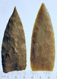
Report author, Glenn T. Goode, an accomplished flintknapper and lithic analyst, carried out an exhaustive analysis of the stone tools recovered from the site. Though tools from the Late Archaic through the Late Prehistoric were represented in the assemblage, Goode’s analysis focused on tools from the earliest part of the Late Archaic period, which he referred to as the Round Rock period. The analysis centered on Pedernales and Kinney dart points, the most common projectile point styles in the Round Rock layers of the site.
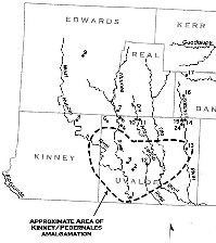
Goode used his experience in flintknapping along with use-wear analysis to determine that, although Pedernales points from Anthon showed evidence of use as projectile points, Kinney “points” mostly seemed to have been used as knives. Though he argued convincingly that the two artifact types served mainly different functions, Goode observed strong similarities in how the Pedernales and Kinney points/knives were produced. He inferred that both styles were made by individuals sharing a single cultural tradition. He also undertook a study of the documented distributions of Pedernales and Kinney points and showed that the two types have only been found together in large numbers in the ecotonal area between the Edwards Plateau and South Texas Plains.
Adding up the evidence, Goode argued that Pedernales and Kinney were complimentary implements – dart head and butchering knife, respectively – in a lithic toolkit used by related Indian groups who lived mainly on the nearby Edwards Plateau. These Late Archaic peoples, he reasoned, camped at the Anthon site during periodic movements south from their primary territory to exploit the unique resources found in the ecotone between the Edwards Plateau and South Texas Plains. This is a good lesson – the geographic and ecological regions we archeologists use today as convenient study areas do not always, or perhaps even often, neatly coincide with prehistoric cultural boundaries. Goode’s study shows the value of a well-informed lithic analysis, particularly at sites such as Anthon where poor preservation conditions give us only a limited set of evidence – stone tools, tool-making debris, cooking stones, and little else. This challenging circumstance is true of a great many archeological sites across the South Texas Plains.
Contributed by Jeff Taff.
References:
Goode, Glenn T.
2002 The Anthon Site: A Prehistoric Encampment in Southern Uvalde
County, Texas. Texas Department of Transportation
Environmental Affairs Division, Archeological Studies Program
Report 38, Austin.
Weir, Frank A.
1976 The Central Texas Archaic. Ph.D. dissertation. Department of
Anthropology, Washington State University, Pullman.