Back
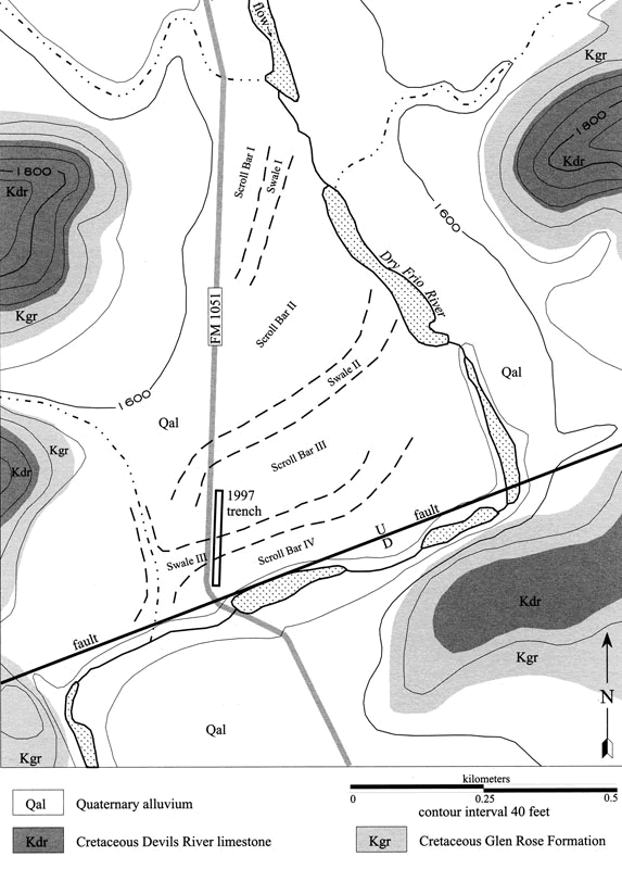
Geological landscape map of the Dry Frio River valley in the vicinity of the Woodrow Heard archeological site (41UV88). The 1997 trench was done long after the excavations were completed in order to gain much-needed geoarcheological information during the site analysis and reporting phase. Geologist Tom Gustavson drew this map based on his field observations and aerial photographs. The archeological site extends across much of the central area of the map in the triangular area formed by FM 1051 and the curving river. This area is a large floodplain and the swales mark old river channels that were abandoned as the river migrated to the east over the last 15,000 years or so.
Back