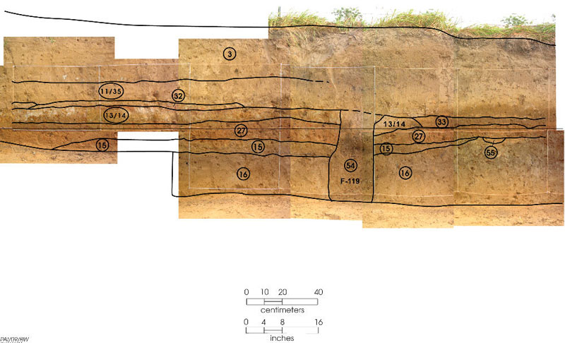
This photograph is out toward the edge of the mound. It shows the thin first mound layers (Zones 15 and 27) sitting on the natural ground (Zone 16). The Zone 13/14 burned surface is above that, with vertical Zone 54 (F-119) probably having held a post that jutted above that surface. Most of the dirt above that likely is slopewash from erosion of the upper part of the mound.