|
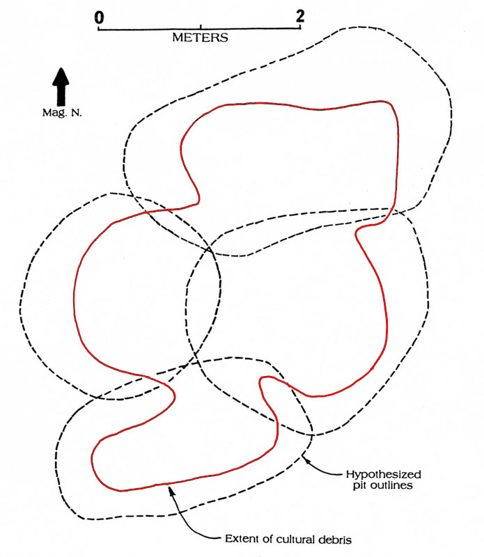
| Interpretive plan map of the overlapping set of probable storage pits designated as Feature 9. The dashed line indicates the estimated outlines of the pits at their origination surface, which would have been within the upper dark brown sandy soil (removed by machinery). The red line shows the outline of the debris within the lower pits intruding into the underlying tan shell hash layer. Ricklis 1994, Figure 5.32. |