|
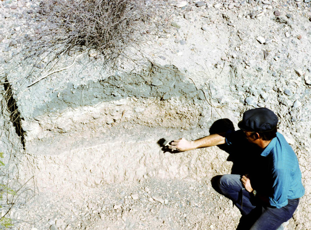
| Stratigraphic profile at Loma Alta created by cutting back an arroyo wall during a 1973 survey in advance of a flood control project. The photograph is labeled "midden zone," but the thin white layer that archeologist James Ivey is brushing off could well be a pithouse floor. Regardless, there appear to be two layers with dark organic staining separated by a thick "clean" layer similar to the one described above in Kelley's sequence of events as "washed gravels, silts, and sand mixed with older refuse." Photo by Vance Holliday, TARL Archives. |