|
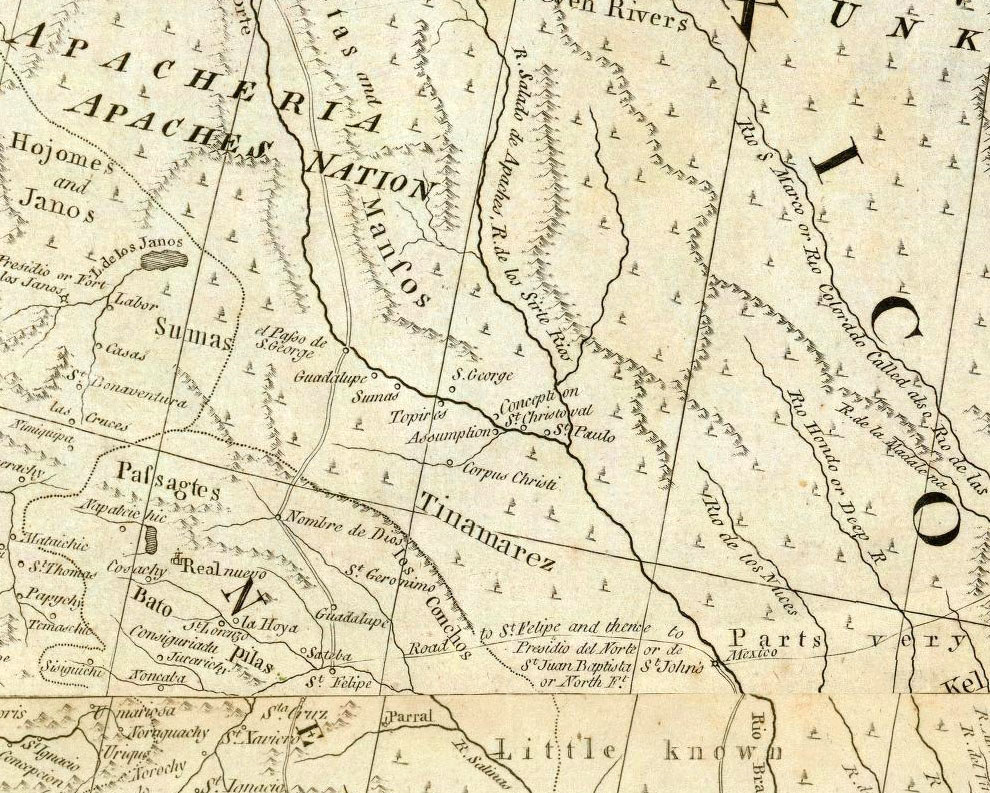
| This 1776 map by British cartographer and publisher Thomas Jefferys reflects the inevitable geographic knowledge and publishing time lag of the day. Much of what the British knew about New Spain came from maps, charts, and sketches captured from Spanish warships as well as from published French maps. The string of named pueblos shown in the La Junta area appears to be taken from Delise’s 1708 map. Note, however, the depiction of the Apacheria not far to the north. The large size of the lettering reflects the growing threat of the mounted raiders to the northern frontier of New Spain. Map source: David Rumsey Collection. |