|
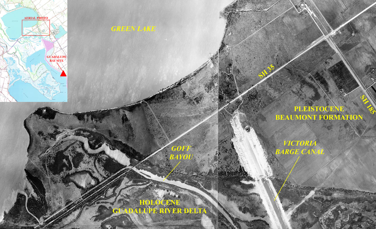
| Aerial photo mosaic dating to the early 1960s showing the Victoria Barge Canal being excavated through the peninsula of Beaumont Formation located immediately south of Green Lake. Note the fresh spoil deposits lining both sides of the canal and the dragline in operation at the northeastern end of the canal cut. This cut has yet to reach State Highway 35 where today a highway bridge spans the canal. Insert shows the location of the aerial mosaic on a portion of the modern quadrangle maps of the area. Location of the Guadalupe Bay site also is illustrated on the insert. (Aerial images courtesy of the late Cecil Calhoun. Insert map after 1995 Green Lake, Texas, and 1973 Austwell, Texas, 7.5-minute USGS topographic quadrangles.) |