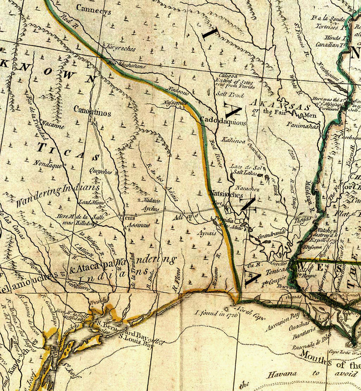
Detail of 1776 map by British cartographer Thomas Jefferys showing the boundary between New Spain (Spanish Mexico) and French Louisiana. The French territory is outlined in green while Spanish territory is outlined in yellow. By the time this map was published, France had ceded its holdings to Spain in 1762 and Los Adaes had been abandoned in 1773, but map accurately shows the Spanish-French frontier as it existed in the mid-18th century. Source: David Rumsey Map Collection.