|
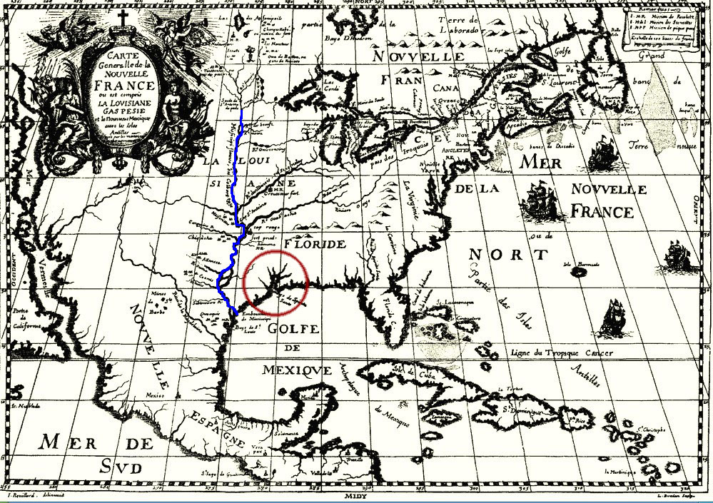
| Map confusion. Early French map showing the charted course of the Mississippi River (denoted here as a blue line) far west of its true course and its actual mouth (outlined in red) near present-day New Orleans, some 400 miles upcoast from La Salle’s landing point. La Salle was hampered by inaccurate maps and navigational devices. |