|
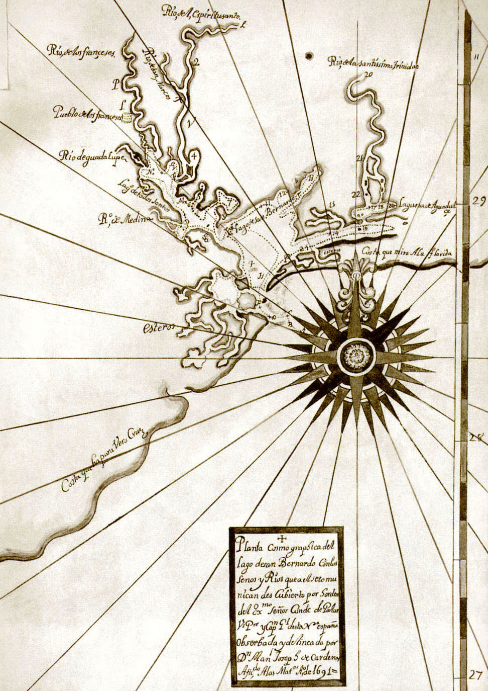
| Manuel Joseph de Cárdenas y Magańas’s 1690 map of the Matagorda and Lavaca bay area of Texas. Discovered in archives in Spain by historian H. E. Bolton, the map showed the route of the Cardenas-Llanos Expedition and detailed the exact location of the French settlement (note “Pueblo de los franceses,” town of the French, denoted on the upper “Rio de los franceses”. Courtesy of the Center for American History, J. P. Bryan Collection (original in Archivo General de Indias, Seville). |