Mortuary Traditions
The mortuary traditions or human burial patterns of the South Texas Plains give us fascinating and unique insights into prehistoric life. Cemetery locations and characteristics reflect how native groups used the landscape, how and when they established territories, and where populations were concentrated. Grave types and associated offerings reflect ritual life and hint at religious beliefs. Grave associations also tell us something about how people lived and how they were connected by trade or exchange to peoples in other regions. The physical and chemical characteristics of human bones reflect ancient diet and health. Indeed, when properly investigated and studied, prehistoric cemeteries and isolated burials are extraordinary sources of scientific information about the lives of native peoples. Yet ancient burials and burial places are often controversial topics today.
Many American Indians feel a strong ancestral connection to prehistoric cemeteries and individual graves and consider these to be sacred places that should be left undisturbed. Yet modern life continues apace and prehistoric (and historic) graves are often found directly in the path of development and land modification. With the passage of the Native American Graves Protection and Repatriation Act (NAGPRA) of 1990, there are now formal procedures that cover how scientists and descendant groups consult with one another and handle human remains encountered on federal lands, as well as those that are held by institutions that receive federal funds. Such remains are often reburied, sometimes after scientific study and sometimes with little or no study. When the graves can be linked to direct descendants and descendant groups, few would dispute the descendants' rights to speak for their ancestors. But in areas such as the South Texas Plains, where so few native groups survived in any form, it is very difficult or impossible to link prehistoric graves to direct descendants.
Most archeologists today acknowledge that scientific and Native American perspectives are both valid and see that respectful compromise is the preferred path to resolving and avoiding conflict.
Quite a few cemeteries and isolated burials are known from the South Texas Plains and adjacent areas. Most of these have been discovered accidentally on private land by land modification activities (e.g., pond digging, post-holes, plowing, etc.), construction, and erosion. Many such localities are known only from after-the-fact accounts, minimal documentation, and from collections of grave offerings that have been shown to archeologists. Relatively few cemeteries and isolated burials have been scientifically excavated and properly documented. Still, some interesting patterns have emerged.
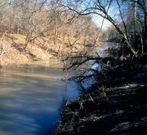
Most burials and virtually all of the cemeteries in the region occur along the major rivers and their tributaries. This is no coincidence; these riverine and river valley settings have the highest concentrations of natural food resources (plants and animals) across the South Texas Plains, and prehistoric groups heavily used and lived in these areas. Below we briefly characterize the mortuary traditions in two areas of the region – the San Antonio-Guadalupe and the Inland Rio Grande areas. The largest cemetery known in the region, the Loma Sandia site, is located in between these two areas on a tributary of the Nueces River in the central part of the South Texas Plains (see Loma Sandia). Neither isolated burials or cemeteries are known to occur in the poorly watered brush country of deep South Texas south and west of the Nueces River and east of the Rio Grande.
San Antonio-Guadalupe: Many of the largest and best documented cemeteries in the region occur within the drainage basins of the San Antonio and lower Guadalupe Rivers. Four of these localities are featured elsewhere in the exhibit – to learn more, see Buckeye Knoll, Olmos Dam, Morhiss Mound, and Silo. Along the lower Guadalupe cemeteries were first established during the Early Archaic period around 7,000 years ago (5,000 B.C.).
The Morhiss Mound site is a heavily occupied locality situated on a knoll overlooking an abandoned channel of the Guadalupe River near Victoria where over 250 individuals were buried. Some of the Morhiss graves are now known to date to the Early Archaic, but most are thought to have been interred during the Middle and Late Archaic periods, and most are apparently not concentrated in a discrete cemetery area. See Morhiss Mound.
In contrast, less than five miles away the Buckeye Knoll site contains a true cemetery dating to the Early Archaic was recently investigated using modern techniques. The analysis and reporting of this extraordinary site has been delayed by controversy over reburial issues. Judging from the limited information that has been released, the grave offerings present at Buckeye Knoll include marine shell beads, stone tools, and an unusual array of ground stone artifacts including boat stones and plummets. The marine shells show a strong connection to the coast and several artifacts are made of high-quality chert that comes from the Edwards Plateau. Some of the ground stone artifacts are made of exotic (non-local) materials that originate hundreds of miles away at least as distant as the Ouachita Mountains of Arkansas. These materials and certain artifact forms show that the Early Archaic peoples who buried their dead there were participants in an extensive exchange network that stretched far into the Southeastern U.S. See Buckeye Knoll.
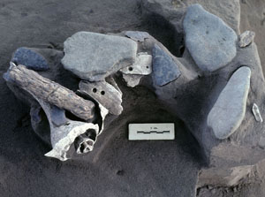
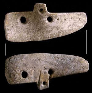
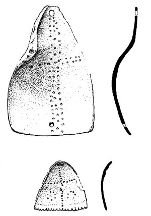
Sizable cemeteries containing at least several dozen individuals are known along the upper and lower San Antonio River that date to the latter part of the Archaic era around 2100 to 2900 years ago (100-900 B.C.). Examples include the Olmos Dam site at the headwaters of the San Antonio River and the Silo site some 100 miles downstream. Among the grave offerings found at the Olmos Dam site are pendants made from freshwater mussel shell and marine conch shell, conch danglers, bone beads, red ochre, and possibly dart points and chert cobbles. The most distinctive aspect of the Olmos site is the placement of multiple sets of deer antler racks over many of the burials. See Olmos Dam. At the Silo site the most distinctive offerings were several sets of large unfinished bifaces and pristine corner-tang knives, both made from Edwards Plateau chert. See Silo.
A recently reported small Late Prehistoric cemetery near the Medina River in southeast Bexar County presents a telling contrast with the Archaic cemeteries mentioned above. The Coleman Cemetery site (41BX568) dates to around A.D. 1300 and contained the remains of several dozen individuals. Two things are striking. First, these individuals were buried with very few grave offerings, in contrast to the pattern seen at Archaic cemeteries. Secondly, analyses of the bones showed that this population had much worse health and more evidence of trauma (broken and damaged bones, probably due to interpersonal violence) than the people buried in the region's Archaic cemeteries. Their bones show they suffered from poor nutrition and underwent periods of starvation.
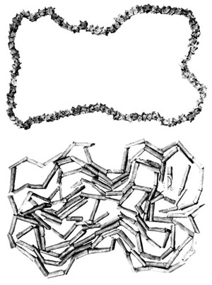
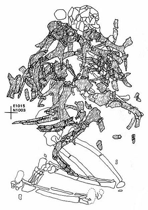
Inland Rio Grande: Many burials have come to light along the Rio Grande in the Falcon Reservoir area on both sides of the river and into northeastern Mexico along the Rio Salado. Most were uncovered by wave action and discovered when prolonged drought conditions in the 1990s greatly lowered the reservoir level. These occur as isolated burials and in small cemeteries, only one of which is known to have contained more than 10 individuals. The isolated burials are typically found within campsites marked by dense accumulations of living debris, while the small cemeteries seem to have been placed in special locations that are not part of occupation zones. Most burials are tightly flexed or “bundled,” a term meaning that the bones were apparently gathered or bound together (perhaps within a woven mat or leather container) and brought to the burial site from some distant location. Some burials are covered by rocks, in some cases forming cairns (visible piles). A considerable variety of grave offerings occur including projectile points, bifaces, tubular stone pipes, bone and marine shell beads, and marine shell ornaments, but other burials lack preserved offerings of any sort.
Most of the Inland Rio Grande burials seem to date to two periods, the late Middle Archaic about 2500-2800 years ago (500-800 B.C.) the Late Prehistoric and about 400-1000 years ago (A.D. 1000-1600). The range of grave offerings found in the Archaic burials is similar to that found at Loma Sandia, including stone tools, tubular stone pipes, and marine shell ornaments. In contrast, the Late Prehistoric grave offerings have more in common with those known from the Rio Grande Delta area, such as bird bone beads and drilled canine and human teeth.
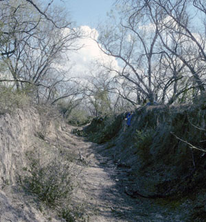
Collectively, the mortuary traditions of the South Texas Plains suggest that native groups formed well-defined territories that were centered on the major river valleys. Within these territories they established compact cemeteries that were used over and over again for generations. Although the best known period is the Late Archaic, it is likely that more Early Archaic and Middle Archaic cemeteries will come to light along the major drainages as modern land modifications take place. The poorly-watered brush country between the Nueces River and Rio Grande appears to have been a zone where people visited in search of seasonally abundant resources (such as prickly pear). But their “home lands” and burial grounds were elsewhere along permanent bodies of water.
Sources
Broehm, Cory J.
2001 Hunter-Gatherer Stress: An Example from Prehistoric South and Southwest Texas. Unpublished M.A. thesis, University of Sheffield, United Kingdom.
Perttula, Timothy K.
2001 Hunter-Gatherer Mortuary Practices in the Rio Grande Plains and Central Coastal Plains Archeological Regions of Texas. La Tierra 28(3 & 4).
Potter, Daniel R., Robert B. Pickering, and Charles E. Mear
2005 Salvage Excavation at the Coleman Cemetery Site, 41BX568. La Tierra 32(1).
![]()