|
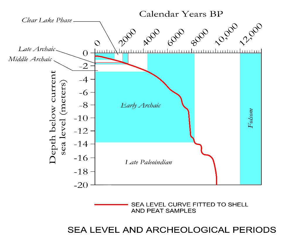
| Radiocarbon assays of submerged peat and shell beds in the northern Gulf extend far enough back in time to allow reconstruction of sea level for Late Paleoindian to modern occupation periods. For Clovis and Folsom occupations, we must rely on reconstructions like those based on uranium-thorium dated corals from Barbados (not shown here). The vertical axis shows depth below modern sea level; the horizontal axis shows calendar (not radiocarbon) years before 1950 AD. The red curve is a best-fit line for rising sea level based on radiocarbon assays (adapted from Milliken, Anderson and Rodriguez (2008:Fig. 4). The left-hand intercept of the curve is below the zero point because dated materials include basal peats and swash-zone shells that actually reside slightly below sea level. Graphic by Ken Brown. |