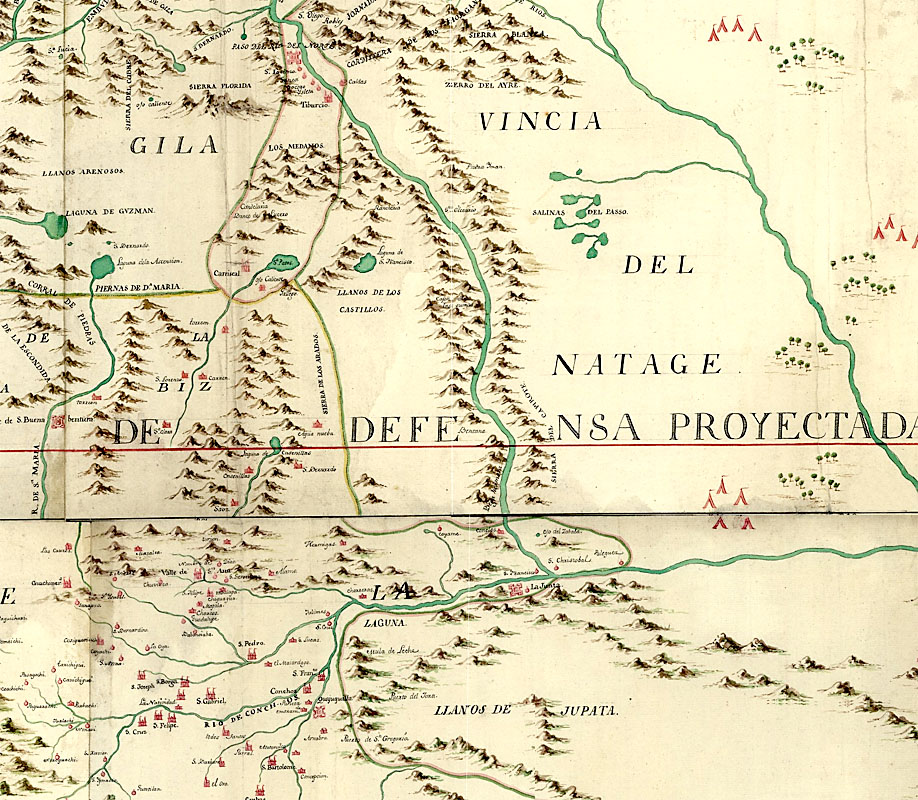
Enlarge to see still larger area and the legend.
|
| Portion of 1769 map by Captain Joseph Ramón de Urrutia y de las Casas, cartographer of the Spanish Royal Regiment of America. Urrutia accompanied Marqués de Rubí on an official inspection of all of the presidios of the Spanish province of Texas. This is one of the earliest maps that depicts La Junta by name and properly shows the confluence of the two rivers. It also shows burgeoning Spanish settlement across what is today southern and western Chihuahua, Mexico. Enlarge to see still larger area and the legend. |