|
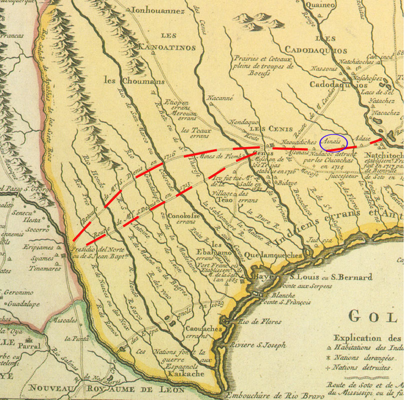
| Portion of a colorized version of the famous Delisle map of 1718 t0 which dashed lines have been added to show several of the alternate routes that fell within the corridor that came to be known as El Camino Real de los Tejas. The location of the Ais villages near where Mission Dolores was built is circled in blue. |