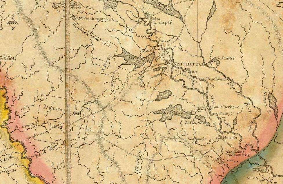
Detail of 1816 map by William Darby showing the Los Adaes region. The location of the abandoned Spanish presidio would not have been known to Darby, but the map depicts Spanish Lake fed by Bayou Adayeês, which is probably the drainage flowing just west of the site near the modern town of Robeline. The road shown leading west from Natchitoches is essentially the route of the Camino Real. Note the shaded upland ridge line paralleling this road. Courtesy David Rumsey Map Collection.