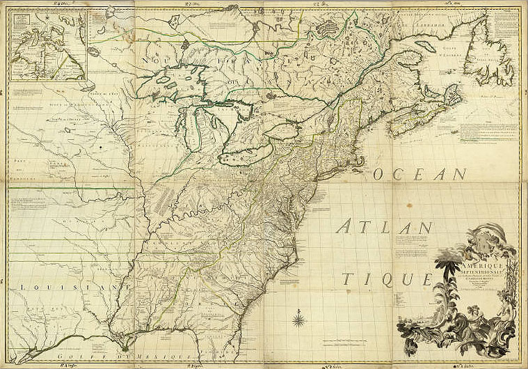
John Mitchell 1755
 Full Map
Amerique Septentrionale |
|
The "Mitchell Map" first published in 1755 is often regarded as the most famous map of (eastern) North America. This hand-colored version was published in Paris in 1756, one of many reprints and editions of the map. British cartographer John Mitchell's map was based on many sources and was used in settling border disputes. The map of the British and French North American claims depicts roads, distances, limits, and the extent of their settlements. It is significant that Mitchell included the trade route or road connecting Natchitoches to Los Adaes to the eastern realms. American Memory Map Collections, Library of Congress. |
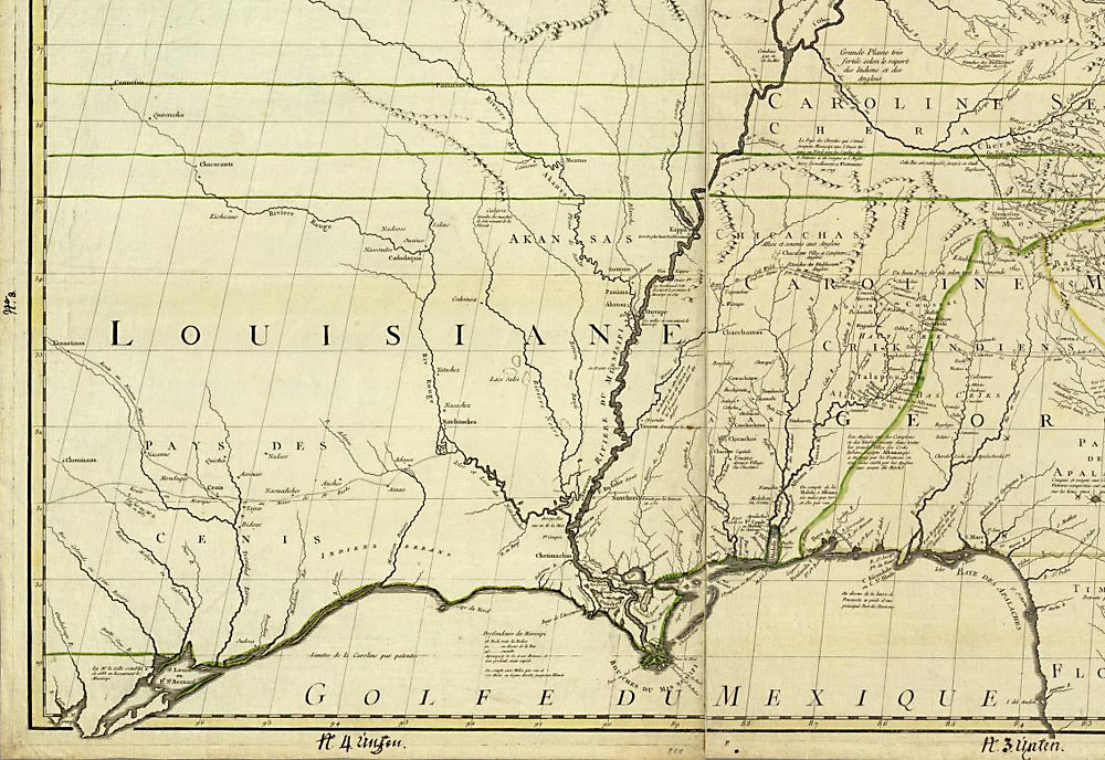 Map Detail
|
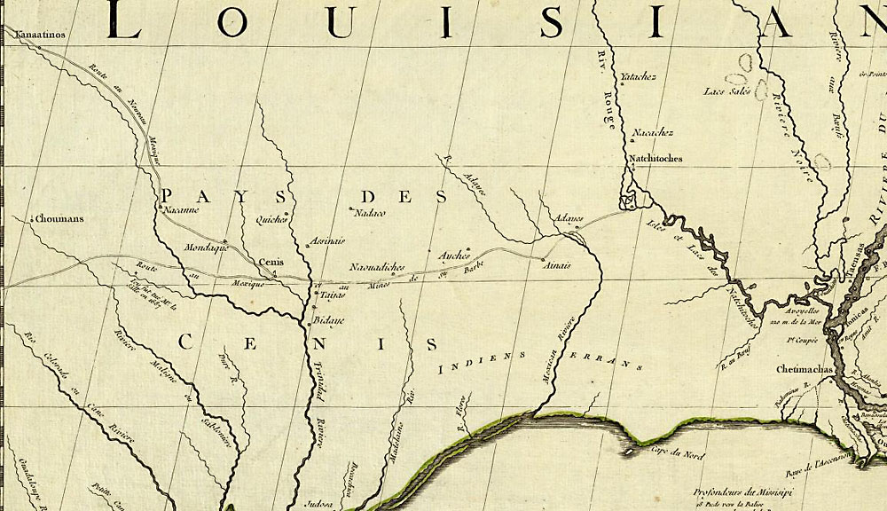 Map Detail 2X |